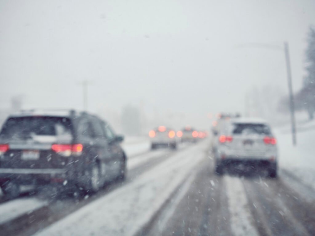
A late-season winter storm is targeting Minnesota’s most heavily traveled highway corridors this week, bringing a dangerous combination of heavy snow, freezing rain, sleet, and gusty winds that will make road conditions unpredictable and hazardous from Wednesday evening through Friday morning.
The National Weather Service Duluth office has issued a Winter Storm Warning for the North Shore of Lake Superior, including Southern Lake and Southern Cook counties. The Warning is in effect from Thursday 1:00 AM CDT through Friday 7:00 AM CDT. Forecasters are calling for 7 to 10 inches of total snow and sleet accumulation on the higher terrain of the North Shore, with ice accumulations around one-tenth of an inch and wind gusts reaching 35 MPH. This is an upgrade from the Winter Storm Watch that had been in place earlier, signaling that NWS Duluth forecasters now have high confidence in the severity of this event.
Heavy Snow and Ice Threaten Northeastern Minnesota
The Warning zone along the North Shore is the epicenter of this storm, but the threat extends well beyond the Lake Superior coastline. Winter Storm Watches are active from Wednesday evening through late Thursday night for a broad swath of northeastern and north-central Minnesota, including Pine, Carlton, South and Central St. Louis, Cook, Lake, Crow Wing, Aitkin, Cass, Itasca, Wadena, and Hubbard counties. The watches also extend into northwestern Wisconsin, covering Ashland, Bayfield, Douglas, and Iron counties.
In the core of the Watch zone, NWS Duluth forecasters expect 4 to 9 inches of combined snow and sleet across Carlton, St. Louis, Cook, Lake, and Pine counties. North-central Minnesota, including Crow Wing, Aitkin, Cass, and Itasca counties, could see 5 to 8 inches. Wadena and Hubbard counties are looking at 4 to 7 inches. Ice accumulations of around one-tenth of an inch are possible across the region, adding a treacherous glaze to road surfaces that will be nearly invisible to drivers at speed.
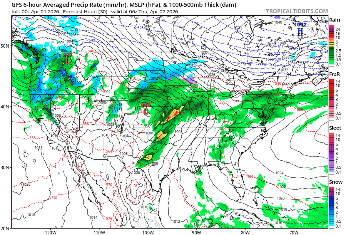
The NWS Weather Prediction Center flagged this system in its Short Range Forecast Discussion, noting that heavy snow and hazardous ice will extend from the Northern Plains to the Great Lakes late this week. The WPC noted that snow will pose the greatest threat across the Dakotas and Minnesota, with up to 6 inches broadly and locally higher amounts in the heaviest snow bands.

Twin Cities and Central Minnesota Face a Wintry Mix
Farther south, the NWS Twin Cities/Chanhassen office has issued a Winter Weather Advisory for the metro area from 7 PM Wednesday to 7 PM CDT Thursday. The Twin Cities are not expected to see the heaviest snow totals, but the storm will still deliver a messy and disruptive combination of precipitation types. Forecasters expect up to 3 inches of snow, approximately 1 inch of sleet, and ice accumulations around one-tenth of an inch for the metro.
The most dangerous element for Twin Cities and central Minnesota drivers is the rapid transition between precipitation types. The storm is expected to move in as rain on Wednesday evening before transitioning to freezing rain overnight, then shifting to a rain, sleet, and wet snow mix during the day Thursday. That pattern means road surfaces will cycle through wet, icy, and slushy conditions in a matter of hours, giving highway crews limited windows to treat pavement effectively.
Need New Tires? Save Up To 30% at Tire Rack
Find the perfect tires for your exact vehicle and driving style. Click here to shop all top-tier brands, including Michelin, Bridgestone, and more, directly at Tire Rack.
I-35 Corridor and Highway 61 At Risk
The I-35 corridor from the Twin Cities north to Duluth is the primary highway concern with this storm. Drivers traveling northbound will encounter progressively worsening conditions as they move from the Advisory zone in the metro through the Watch zone in Pine and Carlton counties and into the Warning zone along the North Shore. The transition from rain and sleet near the metro to heavy, accumulating snow north of Hinckley could happen within a span of 30 to 40 miles, catching drivers off guard if they set out in conditions that appear merely wet.
Highway 61 along the North Shore, one of Minnesota’s most iconic scenic routes, is squarely in the Warning zone and will be among the hardest-hit roads. Highway 61 closures have recent precedent: during the February 17-19 blizzard, both directions of Highway 61 were shut down overnight between Duluth and Grand Marais, with MnDOT advising against travel even after the road reopened.
Central Minnesota’s I-94 corridor from St. Cloud through the Alexandria and Fergus Falls area is also at risk, particularly with the 3-to-5-inch snow and sleet totals forecast under the Winter Weather Advisory. Sleet accumulations of nearly an inch can create a layer of small ice pellets on the road surface that is extremely difficult for plow blades to clear effectively.
Getty Images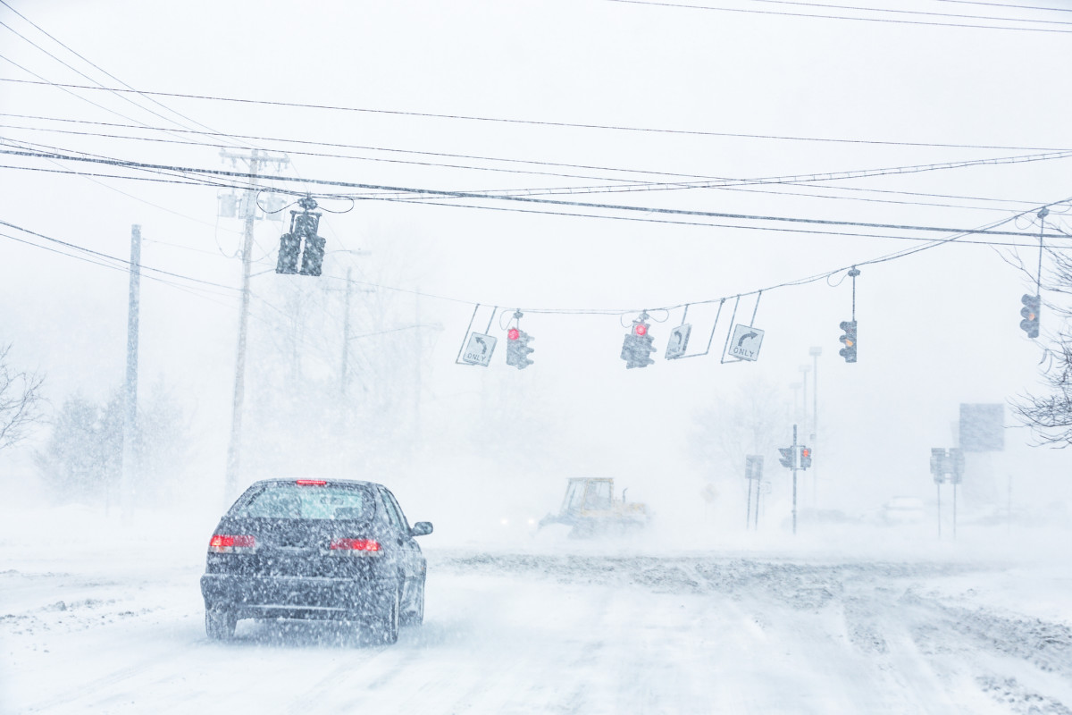
What Drivers Should Know
The first question to ask is whether the trip is necessary. If you are planning to drive the I-35 corridor north of the Twin Cities on Thursday, you should seriously reconsider. The NWS Watch language for northeastern Minnesota specifically states that “travel could be very difficult,” and the Warning zone language is even more direct.
For drivers who must travel, reduce your speed well below posted limits. This storm’s mixed precipitation is especially dangerous because road conditions will change rapidly and without warning. A stretch of highway that appears merely wet can transition to a sheet of black ice within a few hundred yards as temperatures hover near the freezing mark. Disable cruise control entirely.
Cruise control is one of the most dangerous features to use on icy or slushy roads because it prevents your foot from being in contact with the pedals, delaying your reaction time if the vehicle begins to lose traction. When a tire hits a patch of ice while cruise control is engaged, the system may attempt to accelerate to maintain speed, which can trigger a loss of control.
Both the Thursday morning and Thursday evening commutes are expected to be impacted across the Advisory and Watch zones. If your employer offers flexibility, consider adjusting your schedule to avoid peak commute windows during the heaviest precipitation.
Keep an Emergency Kit in Your Vehicle
Every vehicle traveling in winter storm conditions should carry a basic emergency kit. Minnesota’s highway network covers vast stretches of rural terrain between population centers, and a breakdown or slide-off in a snowstorm can become a survival situation quickly. Your kit should include a warm blanket or sleeping bag, a flashlight with fresh batteries, a portable phone charger, bottled water, non-perishable snacks, a basic first aid kit, a small shovel, and a bag of sand or cat litter for traction if your vehicle gets stuck. For drivers headed into the North Shore Warning zone, add a bag of road salt and consider packing tire chains if your vehicle can accommodate them. For more on preparing your vehicle for severe weather, Autoblog’s winterizing your car guide covers the full checklist.
Tires Are Your First Line of Defense
Your tires are the only point of contact between your vehicle and the road, and in a mixed-precipitation event like this one, they are the single most important safety variable. Dedicated winter tires with the Three-Peak Mountain Snowflake (3PMSF) rating dramatically outperform all-season tires in cold temperatures and on icy surfaces. Testing by Tire Rack has shown that winter tires improve braking distances by approximately 35 percent compared to all-season tires in cold and snowy conditions.
Even if you are running quality all-season tires, check your tread depth before heading into this storm. Autoblog recommends a minimum of 4/32 inches of tread for safe winter driving. Anything less and your tires cannot effectively channel water, slush, and snow away from the contact patch, increasing the risk of hydroplaning and loss of control.
Cold weather also reduces tire pressure. For every 10-degree Fahrenheit drop in ambient temperature, tire pressure drops approximately 1 to 2 PSI. With temperatures dropping sharply behind this system, a tire that was properly inflated earlier this week could now be running significantly underinflated. Check your pressures before any trip into the storm zone. An underinflated tire reduces traction, compromises handling, and increases the risk of a blowout, which is among the worst mechanical failures to experience on a snow-covered highway.
For a deeper look at choosing the right rubber for conditions like these, see Autoblog’s guide on buying winter tires and our breakdown of the best cars and SUVs for winter driving.
Snow/Ice Totals by Zone
| Zone | Snow/Sleet | Ice | Wind Gusts |
|---|---|---|---|
|
North Shore higher terrain |
7-10 inches |
~0.1″ |
35 mph |
|
NE MN (Carlton, St. Louis, Cook, Lake, Pine) |
4-9 inches |
~0.1″ |
35 mph |
|
North-central MN (Crow Wing, Cass, Itasca, Aitkin) |
5-8 inches |
— |
35 mph |
|
Wadena/Hubbard |
4-7 inches |
— |
— |
|
Central MN (Stearns corridor) |
3-5″ snow + 0.75″ sleet |
~0.1″ |
— |
|
Twin Cities metro |
Up to 3″ snow + ~1″ sleet |
~0.1″ |
— |