
Source: Community Science
Heat, air pollution, and flooding can affect a city and the health of city residents. Yet few cities have a comprehensive network of weather stations providing accurate measurements of rainfall, humidity, and air temperature across different neighborhoods. Some of this information can be filled in by community members’ personal weather stations, like those connected through Weather Underground. But because of a lack of sensors and inconsistencies in data collection, these types of community networks are often not reliable on their own. Furthermore, most personal weather stations are located in higher-income neighborhoods, with very few in lower-income, underserved neighborhoods.
The same is true in Baltimore, where personal weather stations are more prevalent in higher-income, majority-white neighborhoods around and stretching north from the Inner Harbor but are lacking in lower-income and majority-Black neighborhoods to the west and east. Furthermore, only one National Weather Service sensor is present in the city itself, in the Inner Harbor, and another sensor is located about 12 kilometers (8 miles) away at Baltimore/Washington International Airport.
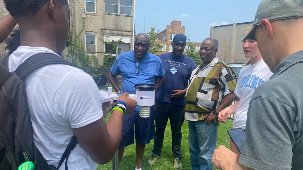
Waugh et al. describe a partnership between universities, state agencies, and Baltimore residents to build the Baltimore Community Weather Network (BCWN) that addresses the missing data coverage around the city. Unlike the patchwork of personal weather stations, community members participating in the BCWN are from underserved areas in the city and are actively involved in data collection and interpretation.
Weather stations are placed in open spaces to avoid obstacles like buildings or trees affecting measurements of temperature, rainfall, or wind. This careful placement is designed to ensure that the data collected are as close as possible to the conditions experienced by actual residents.
BCWN sites are carefully monitored and managed by community members. Baltimore residents are actively involved in data collection, weather station management, and decisionmaking with scientists and local organizations to help promote engagement, education, and community empowerment.
Because Baltimore is not the only U.S. city that has historically lacked accurate weather data coverage, the BCWN system could be applied to other locations—or even used to monitor other environmental exposures, such as air pollution, the authors say. (Community Science, https://doi.org/10.1029/2025CSJ000154, 2026)
—Rebecca Owen (@beccapox.bsky.social), Science Writer

Citation: Owen, R. (2026), Fixing Baltimore’s unequal weather data coverage, Eos, 107, https://doi.org/10.1029/2026EO260108. Published on 13 April 2026.
Text © 2026. AGU. CC BY-NC-ND 3.0
Except where otherwise noted, images are subject to copyright. Any reuse without express permission from the copyright owner is prohibited.