A Pacific cold storm hammering the Sierra Nevada is in its peak phase today, Monday, May 4, 2026, with the Weather Prediction Center flagging both today and Tuesday at HIGH heavy snow risk, the top of the four-tier scale, a notable upgrade from the original outlook. The same upper-level low then reloads over the Colorado Rockies for a second-act event Tuesday into Wednesday, extending the impact zone from the Northern Sierra all the way to the I-70 corridor west of Denver.
Peak Driving Danger Window
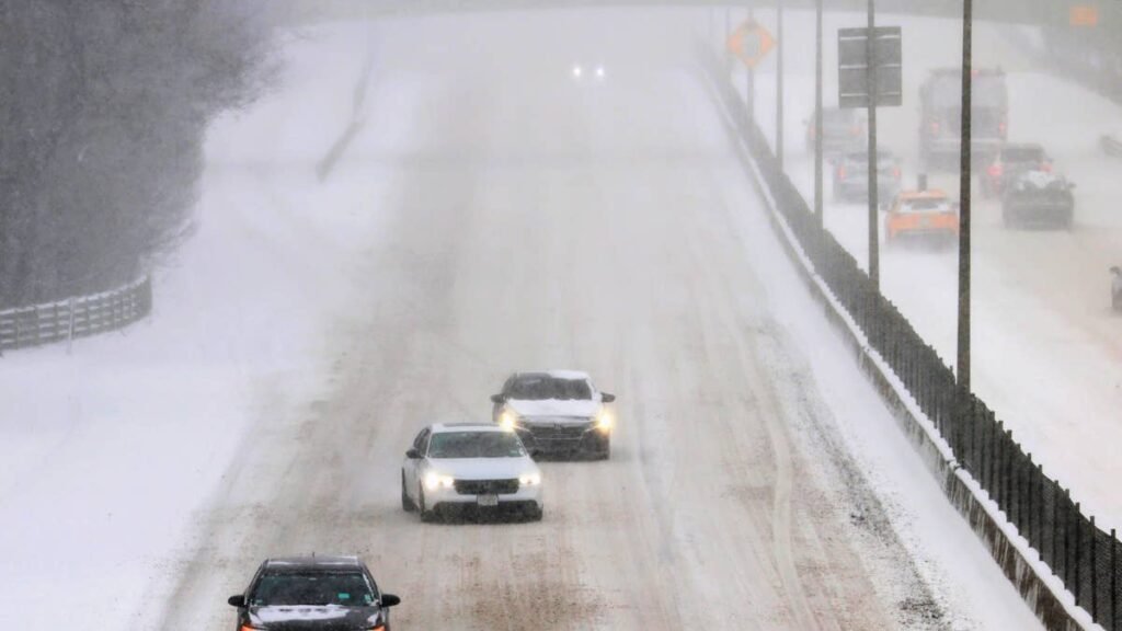
The worst window runs Monday afternoon into Tuesday morning across I-80 at Donner Pass and Highway 50 at Echo Summit, where 80 MPH crest gusts and snow levels crashing to 4,500 feet will combine to produce near-zero visibility and triple-digit accumulation rates above 7,000 feet.
What to Expect
- Snow totals: Up to 48 inches at the highest Sierra peaks, 24 to 36 inches at pass level, 12 to 18 inches in the Tahoe basin
- Wind gusts: 80 MPH along the Sierra crest, 50 to 60 MPH at pass level
- Snow level: Dropping to 4,500 feet by Tuesday morning
- Worst corridors: I-80 Donner Pass, Highway 50 Echo Summit, I-70 Vail Pass and Loveland Pass on the back end
- Risk category: WPC HIGH (top tier) for both Monday and Tuesday
NWS Sacramento covers the West Slope warnings, NWS Reno covers Tahoe and Mono County, and NWS Hanford covers Yosemite, Kings Canyon, and Sequoia. The system is pulling subtropical moisture into the Sierra at unusual intensity for early May.
Road Conditions
I-80 over Donner Pass and Highway 50 over Echo Summit face likely full closures Monday into Tuesday during the peak burst, with chain controls almost certain on either side of the closure window. Caltrans is staging plow rotations; check QuickMap before any Sierra crossing. Refreeze risk is elevated Tuesday night as snow level crashes and standing water locks up. If you’re unsure how your drivetrain handles deep snow, the AWD vs 4WD distinction is worth a refresher.
The Two-Act Storm: Rockies Next
The same upper-level low will track east and redevelop over Colorado Tuesday into Wednesday, with NWS Boulder and NWS Grand Junction issuing watches and warnings for the I-70 corridor. WPC has Colorado in the same HIGH risk classification for Tuesday, putting Vail Pass, Loveland Pass, and the Eisenhower Tunnel approach at major operational risk midweek.
Winter Driving Tips
Tread depth matters more than tire age. The Lincoln-head test sets the legal floor at 2/32, but anything below 4/32 loses meaningful grip in unpacked snow. Drop tire pressure 1 to 2 PSI per 10 degrees of temperature drop to maintain proper contact patch. Triple your following distance on snowpack and double it on wet pavement. Our best vehicles for snow roundup and winter driving fundamentals guide cover equipment and technique. Colorado-bound drivers should bookmark COtrip.org for live I-70 status.
Timing
The Sierra peak runs Monday afternoon through Tuesday morning, with refreeze risk Tuesday night. The Colorado event ramps up Tuesday afternoon, peaks Tuesday night into Wednesday morning, and tapers Wednesday afternoon. A drier pattern arrives by late Thursday. We’ll update this article as conditions evolve.