It is the last weekend of June, and a Winter Storm Warning is up across the mountains of central Idaho and southwest Montana. NWS Missoula upgraded its watches to a warning on Friday, and it runs through Monday morning.
The alert is for the high country around Salmon, the Bitterroot, and the Sapphire ranges. A cold Pacific trough is driving the whole thing, dropping snow levels to roughly 6,500 feet just days before July.
The most dangerous window is Saturday night into Monday morning, when heavy wet snow above 6,500 feet can drop limbs across backcountry roads and leave US-93 over Lost Trail Pass slushy and slick for anyone crossing the Idaho-Montana line.
What to Expect
The warned zones, Western and Eastern Lemhi County in Idaho plus the Bitterroot, Sapphire, and Butte-Blackfoot areas in Montana, are looking at 4 to 8 inches of heavy, wet snow above about 6,500 feet, with isolated totals near 12 inches on the highest peaks. A separate Winter Weather Advisory from NWS Great Falls adds up to 4 inches, locally 8, across Beaverhead County and the Ruby Mountains.
Where the 3 Feet Comes In
The same system stretches west into the Cascades and Sierra Nevada. Weather Prediction Center outlooks put the highest Sierra and Cascade summits in line for up to 3 feet of snow, though that is a peak-only ceiling on terrain well above the warned corridors. Lower passes see far less, and many valleys get cold rain rather than accumulation.
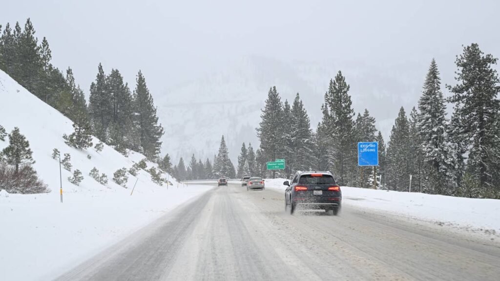
Road Conditions
US-93 over Lost Trail Pass, near 7,000 feet at the state line, is the corridor to watch, along with Idaho 28 through the Lemhi Valley and MT-43 toward Chief Joseph Pass. Expect wet, slushy pavement, reduced visibility in heavier bursts, and downed branches on narrow routes.
The Temperature Crash
The headline story for most people is the cold. Temperatures across western Montana and central Idaho are falling 20 to 30 degrees from late-week summer warmth, with valley highs dropping into the 40s and 50s and freezing levels collapsing onto the peaks.
Timing
Snow began Saturday night, peaks Sunday, and tapers Monday morning as the warning expires around 9 a.m. MDT. Campers and hikers in the high country should drop to lower elevations before it arrives.