Editors’ Highlights are summaries of recent papers by AGU’s journal editors.
Source: Journal of Geophysical Research: Earth Surface
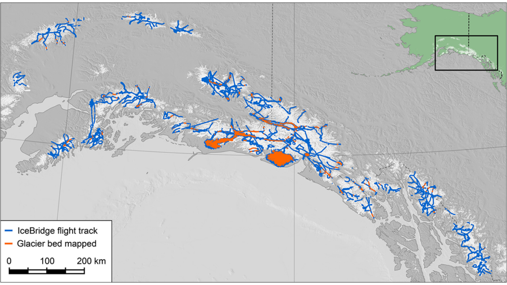
Glaciers in Alaska and northwestern Canada are losing mass faster than any other mountain glacier system on Earth, shedding up to 75 billion tons of ice per year. Predicting how fast these glaciers will shrink requires knowing how thick the ice is and what the bedrock looks like beneath it. However, measuring ice thickness here is difficult: the ice is temperate (near its melting point), which weakens radar signals, and the vast, remote terrain has limited surveys to date.
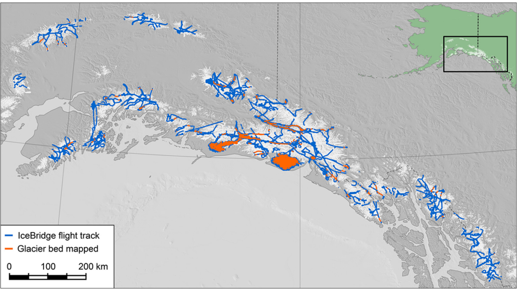
Tober et al. [2026] present the most extensive inventory of glacier ice thickness for this region to date, analyzing a decade of airborne radar data from NASA’s Operation IceBridge to map 5,600 kilometers of ice thickness across 88 glaciers. The radar sounded through nearly 1,500 meters of ice in the Bagley Ice Valley, part of the world’s largest non-polar ice complex. Detailed mapping of the Bering Glacier system reveals a deep trough in the bedrock extending over 50 kilometers that likely traces a tectonic fault concealed by the glacier. The termini of many glaciers across the region sit above basins that deepen farther inland, and continued retreat will expose these as new or expanding lakes. These data will help improve models of glacier change and guide future airborne radar campaigns in the region.
Citation: Tober, B. S., Christoffersen, M. S., Holt, J. W., Truffer, M., & Larsen, C. F. (2026). Alaska-Yukon glacier depths from a decade of airborne radar sounding. Journal of Geophysical Research: Earth Surface, 131, e2025JF008742. https://doi.org/10.1029/2025JF008742
—Winnie Chu, Associate Editor, JGR: Earth Surface
Text © 2026. The authors. CC BY-NC-ND 3.0
Except where otherwise noted, images are subject to copyright. Any reuse without express permission from the copyright owner is prohibited.