Enough satellite and drone imagery is now available to allow some initial analysis of the landslide that started the 26 August 2026 debris flow in Nepal and Tibet.

Much has been written over the last ten or so days about the tragic debris flow that has caused such high levels of damage and loss of life in Tibet and Nepal. The various narratives have at times been excellent, simply wrong, reflective and/or challenging. Loyal readers will know that I tend not to write about events that are being well-covered by others, so I have resisted writing whilst I have been on leave with my daughter Holly.
But it is interesting to note that little has been written about the landslide that started the terrible cascade of events. It is worth some reflection ahead of a detailed analysis that will come from the group convened by Dan Shugar to interpret the event.
There is an incredibly useful compendium of satellite images on a website compiled by the Hidenori Watanave Laboratory at The University of Tokyo. This includes images from Planet Labs, Vantor and Landsat 9 in a very accessible format. It is worth a look, not least because it has imagery of the site of the landslide both before and after failure. Of course, there is also some drone footage of the aftermath that was posted to LinkedIn by Guoxiong Zheng. This allows us to start to understand the landslide itself, but we are going to need better data to fully understand this event.
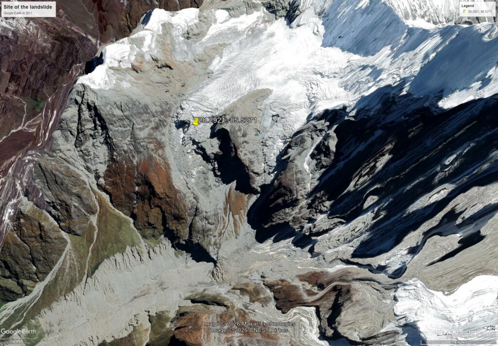
The site of the landslide was [28.2921, 85.5271]. The most recent Google Earth imagery of this site is heavily shadowed, but there is a good image from 2017:-
The Watanave Lab imagery collection has a Planet Labs image from 25 August 2026 showing the site. This is lower resolution than the Google Earth image:-
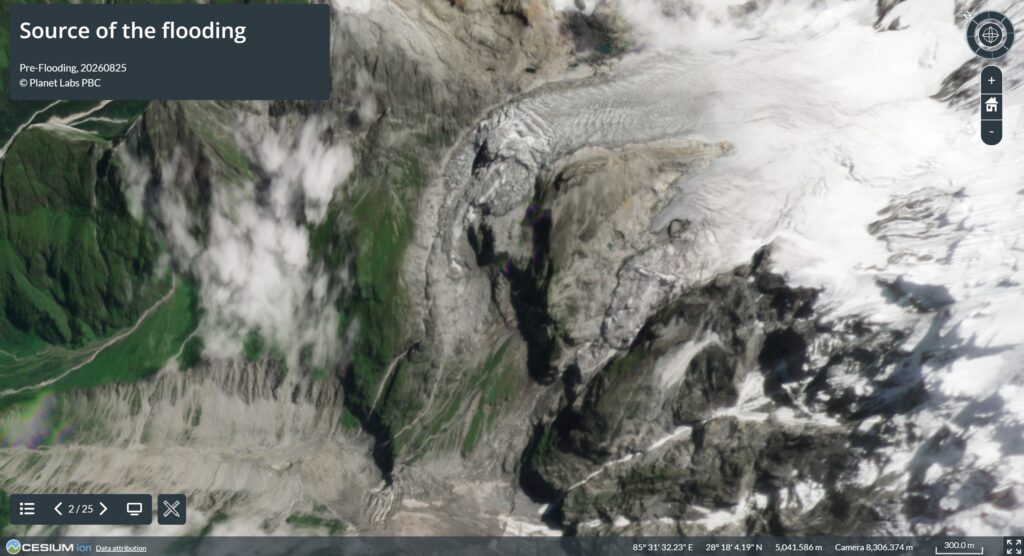
Comparing the two sets of images, I don’t see much that would have indicated that a failure was incipient. Indeed, perhaps the lack of obvious change is a surprise.
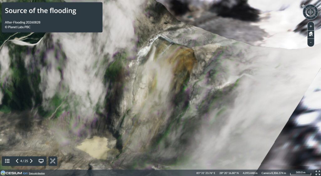
The Watanave Lab imagery has two post-failure images, of which this one is the more useful:-
Two caveats here – first, the image is draped on a DEM that won’t accurately reflect the post-failure topography (see the drone footage below). And second, there is cloud in the imagery that becomes draped on the topography, which is of course an error.
The site of the landslide had a highly complex morphology, with very steep slopes and perhaps a strongly developed overhang. One might hypothesise that this oversteepened upper slope failed catastrophically, triggering failure on the lower slope. There has been much conjecture that climate change might have played a role, and the increased occurrence of these events in general is very likely to be climate-related, but I am uncertain as to whether this particular event has a climate change signature. It is entirely possible that this was a progressive failure in a slope that was both oversteepened and deteriorating.
It is entirely possible to construct a climate change narrative for this event, but it cannot be assumed.
The landslide itself is very large. The source zone is about 2,000 metres long and the elevations are about 5,140 metres at the crown and 3,990 metres at the toe, so about 1,150 metres. This is a very steep slope.
The landslide generated a seismic signal the equivalent of a M=5.7 earthquake, indicating a volume in the order of 100 million cubic metres.
The imagery clearly shows that the shear surface was in bedrock, not within the ice or at the ice-rock boundary. It is interesting to look at the images collected by drone. This is the upper portion of the landslide scar:-
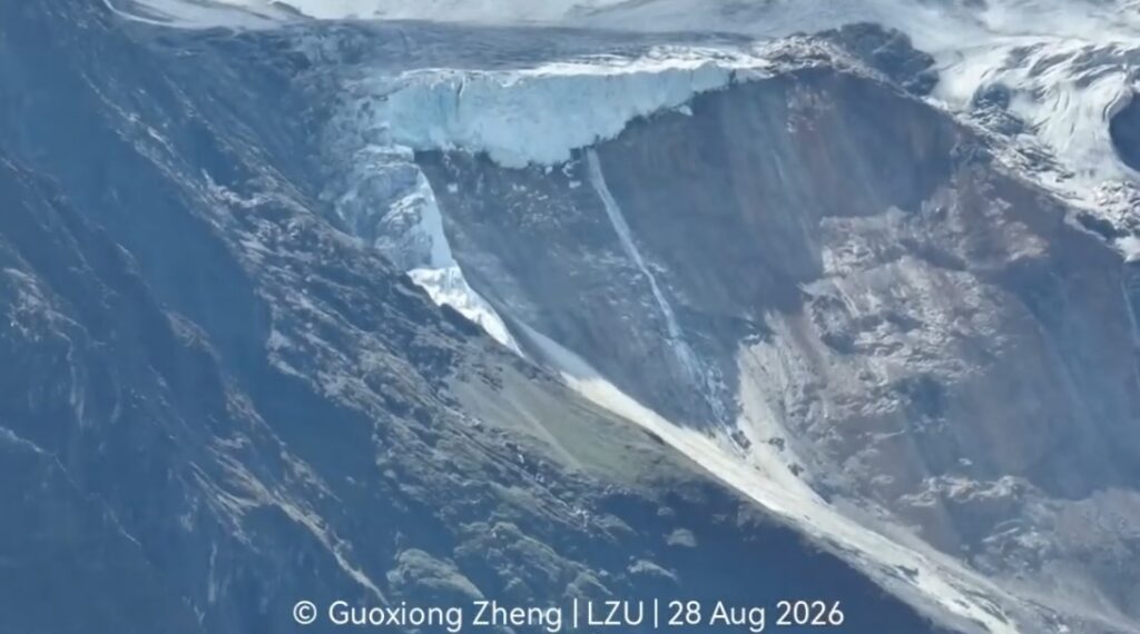
At the crown, the interface between the glacier and the bedrock is clear, confirming that this was primarily a bedrock landslide. The scar has a weak wedge shape in this area (?), probably indicating that the failure exploited existing weaknesses (as you’d expect). Is there a hint that the shear surface is weathered? I suspect so, but it is hard to be certain.
Lower down, the landslide scar is more planar and is covered with debris left behind and that has fallen from the exposed scar:-
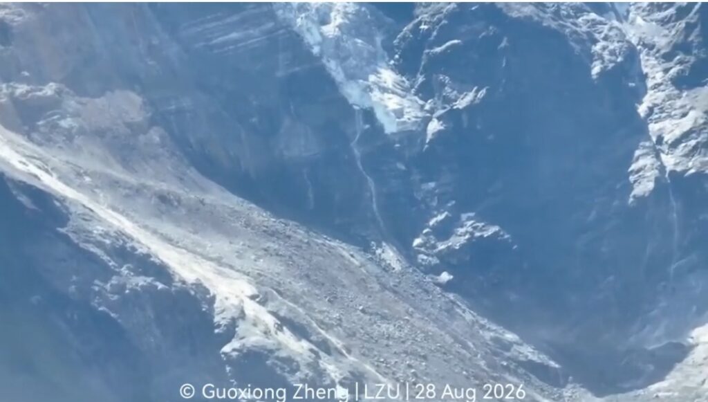
This has now left a very steep slope, albeit one without overhangs, so the potential for further collapses needs to be considered.
The geomorphology of this area, and the slopes along the channel downstream, are now going to evolve. This could involve further collapses in the coming years.
A much more detailed review of this landslide is needed. It will be all too easy to focus on the debris flow and its terrible impacts – and this is important – but we must not lose sight of the need to understand the initial failure too.
Finally, I have seen quite a lot of commentary that this event was in some way unprecedented in scale. It was not. Three much larger landslides and debris flows are recorded in valley fills in the Pokhara area of Nepal. These events are related to earthquakes that occurred in ∼1100, 1255, and 1344 AD – i.e. in the medieval period. These three events generated about 5 km3 of sediment.
The potential for even larger landslides must be considered when proposals to mitigate these hazards through the construction of even larger dams are made.
Text © 2026. The authors. CC BY-NC-ND 3.0
Except where otherwise noted, images are subject to copyright. Any reuse without express permission from the copyright owner is prohibited.