A strong El Niño is building into the fall, and forecasters have been raising their numbers on it all summer. The Climate Prediction Center now puts the chance of a very strong event above 90 percent for the Northern Hemisphere fall and winter, and its August 13 ENSO discussion gives October through December a 69 percent chance of exceeding every El Niño in a record that reaches back to 1950. The warm lean is already showing up in the near term. The 8-14 day outlook CPC issued on September 6 puts temperatures above normal across nearly the whole country for the middle of September, with the strongest signal over the southern Rockies and the Southeast.
That Pacific heat matters well beyond the ocean. An event this size can shift the winter storm track and change where that moisture ends up.
Meteorologists Expect A Strong El Niño This Season
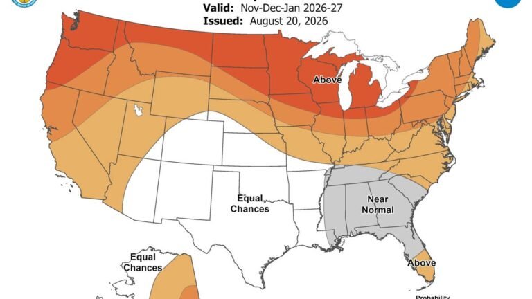
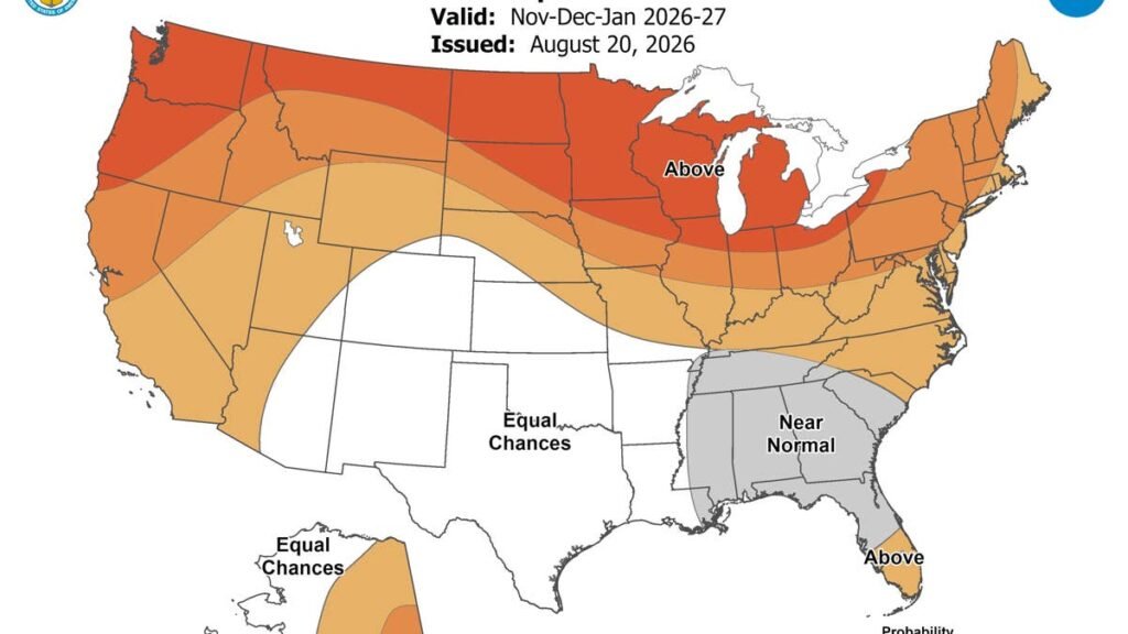
The outlook covering November, December and January leans wet across the southern tier, with the strongest signal on the map sitting over parts of the Southeast at more than 60 percent, and the same tilt running along almost the entire East Coast. Most of that area does not see much snow in a normal year, which is the first thing to understand about a wet map: above normal precipitation is not a snow forecast. View the maps here.
Temperature changes the picture, too. Above normal temperatures are favored across the northern tier and much of the West, while the Southeast is pegged at near normal from this window onward, El Niño’s cooling influence working against a warming trend that pulls the opposite way. The drier side of the forecast covers the northern Rockies and northern High Plains, with a weaker lean over the Great Lakes.
Where The Snow Signal Sits
For anyone looking for an actual snow season, the OpenSnow 2026-27 preview points at the Southwest and southern Rockies. California, Utah, Arizona, New Mexico and the southern and eastern parts of Colorado all carry above normal odds, with the Central Sierra showing the clearest signal of the group. A stronger southern storm track feeds that pattern, sending more systems through areas high and cold enough to hold onto the snow.
Washington runs the other way. Precipitation there lands close to normal while temperatures run warm, so the Cascades may take about as many storms as usual and hold less of the snow. Parts of the northern United States and western Canada finish below average on the same logic.
What A Super El Niño Actually Means
“Super El Niño” is not an official NOAA term. NOAA calls an event this strong “very strong.” Forecasters use the shorthand for events where sea surface temperatures in the reference patch of the Pacific run more than 2 degrees Celsius above normal. CPC has this one well past that, with anomalies in the eastern equatorial Pacific exceeding 3 degrees.
More storms is not the same as more snow. CPC has El Niño impacts increasing slowly at first and then ramping up through the core winter months, with a delayed start across the southern part of the country, and it does not lift coastal California above 50 percent for precipitation until December through February. Where temperatures run too warm, systems arrive as rain instead, particularly at lower elevations in the West. Forecasters attach the same qualifier to all of it: an event this size raises the odds of typical El Niño impacts without guaranteeing them in any particular location.
What It Means On The Road
Drivers in the West and the Southeast are looking at different problems. In the favored western states the hazard is a warm, heavy storm track over high passes, where wet snow at pass level refreezes overnight and leaves a surface that looks merely damp in daylight. Chains and a winter compound tire handle that. All wheel drive divides torque during acceleration and does nothing for braking or cornering once a road glazes over.
Two states already have that written into law. Colorado’s Traction Law has been active on the I-70 mountain corridor between Dotsero and Morrison since September 1 and runs to May 31, covering 126 miles of the road that carries Denver traffic to the ski country the snow forecast favors. It requires 3/16-inch tread on winter, all-weather or mud and snow tires, and under a change that took effect last year two wheel drive vehicles have to carry chains or an approved traction device for the whole period regardless of what tires they run. Noncompliance is a $50 fine plus a $17 surcharge. On the California side, Vail Resorts is targeting November 20 to open Heavenly and Northstar, which puts Tahoe traffic over the passes well before Thanksgiving.
The risk is different across the Southeast, where most drivers are on all season tires. All season compounds generally begin to lose flexibility as temperatures fall toward 45 degrees Fahrenheit, well above the freezing point. That is also the region carrying the strongest wet signal alongside temperatures near freezing, and when the vertical temperature profile lines up the right way, those storms arrive as freezing rain rather than snow. Autoblog went through what that costs last month.
Cold air also costs a passenger car tire about 1 psi for every 10 degrees the temperature drops, so a set checked in August is running low by Thanksgiving with nothing visibly wrong. CPC replaces this set of maps on September 17.