The Atlantic Ocean has had an unusually quiet hurricane season this year. Though there have been six named storms, zero have actually strengthened into hurricanes—a rarity that hasn’t occurred in decades.
On the other side of the country, though, Hurricane Polo has rapidly intensified, becoming one of the most intense East Pacific hurricanes on record.
These weather anomalies may seem at odds, but they’re both impacted by the “Godzilla” Super El Niño that experts say is shaping up to be one of the strongest in history.
El Niño affects weather patterns around the world, and can amplify extreme weather events. And even though El Niño may reduce the number of hurricanes in the Atlantic, that doesn’t always mean the season is less destructive than other years.
It’s late September—where are all the Atlantic hurricanes?
The Atlantic hurricane season spans from June 1 to November 30, though the season tends to peak around September 10, making it unusual, AccuWeather notes, “not to have a hurricane spinning on that date.”
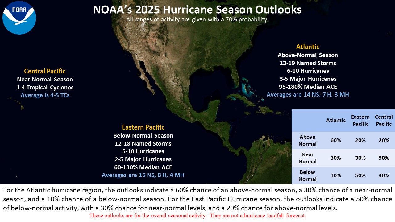
On average, a season sees 14 named storms in the Atlantic, with seven that become hurricanes and three that strengthen into major hurricanes.
By September 24 this year, though, there have still been no hurricanes in that ocean. (Tropical Storm Fay is spinning in the central Atlantic Ocean, but it poses no threat to the United States, experts say.)
“The latest occurrence of the first Atlantic hurricane in the last 100 years was September 21, 1941,” Chad Merrill, a senior meteorologist with AccuWeather, tells Fast Company. “That record is being demolished as we speak.”
“In the entire record of the Atlantic basin, the latest occurrence of the first hurricane was October 7, 1905. It’s yet to be seen if this record is demolished,” he adds.
Hurricanes need three features to form, the U.S. Geological Survey notes: warm ocean water; warm air at the ocean’s surface that can then cool and rise; and “low wind shear,” or little difference in the wind’s speed and direction within different levels of the atmosphere.
A predominant feature of an El Niño is hotter ocean water in the Pacific. But the phenomenon still affects activity in the Atlantic, too.
There’s less of a chance of Atlantic hurricanes during El Niño years because of the way it changes winds: increased wind shear means stronger winds sweeping across the Atlantic, which makes it less likely for storms to form and strengthen.
El Niño fuels more hurricanes in the Pacific
Across the country, hurricane season looks starkly different.
There have already been 16 named storms and six hurricanes that have formed across the Central and Eastern Pacific, fueled by El Niño’s warmer waters and lower wind shear there.
Typically, an El Niño means drier-than-normal conditions in the northeastern parts of the U.S., and wetter-than-normal conditions across the south. El Niños also strengthen the Pacific jet stream, a current of air that flows from west to east.
That stronger jet stream, combined with the hot Pacific ocean temperatures, can strengthen storms that hit the west coast of the country.
The National Oceanic and Atmospheric Administration (NOAA) predicted that the Pacific hurricane season would be above average, with 9-14 hurricanes and 5-9 major hurricanes in that ocean, fueled by this record-breaking El Niño.
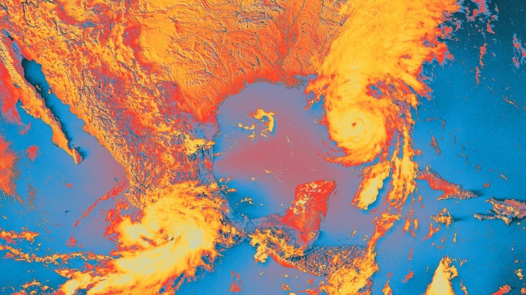
The latest example of this effect is Hurricane Polo, a Category 4 storm off the southwest coast of Mexico that meteorologists have said is one of the strongest Pacific basin storms on record.
Though that storm is off the coast of Mexico, the strong jet stream could draw moisture north bringing a “good chance” of flash flooding to New Mexico, Texas, and Oklahoma, Merrill says.
Experts are also warning that Tropical Storm Nolo in the Pacific could soon be a major hurricane, potentially bringing more than 30 inches of extreme rain to Hawaii’s Big Island.
Super El Niño means all sorts of extreme weather
Though this year’s El Niño may mean fewer Atlantic hurricanes, that doesn’t mean anyone is completely safe from the weather phenomenon’s impacts.
El Niño is a natural phenomenon, but this year’s warm ocean temperatures of El Niño are combining with already record-breakingly hot oceans due to climate change, creating a “Godzilla Super El Niño” that is particularly strong.
It’s not that climate change is directly making the El Niño stronger, climatologist Michael Mann told BCC, but “it’s like a wave that’s on top of a rising tide . . . Every time we get a large El Niño event like this one, it’s sitting on top of a warmer planet.”
That warmth on top of warmth can supercharge extreme weather everywhere.
“When the oceans are warmer, thanks to climate change and the developing El Niño, they release vast amounts of moisture into the atmosphere, which act as extra fuel for any storm,” Union of Concerned Scientists climate scientist Marc Alessi wrote on BlueSky.
That’s evident through Tropical Storm Nolo, which is being fueled by record ocean heat—as well as an early-season Nor’easter developing in the Atlantic, he adds, and the extreme rain in New Mexico.
El Niño could also bring sharp cold fronts into the Great Lakes and Northeast, Merrill notes, and even warm and dry weather to the West, which leads to a higher-than-average fire risk.
In this way, this record-breaking El Niño could be a glimpse into our future, where a warmer world fuels extreme weather that affects the entire planet, in one way or another.