The 21 July 2025 rock avalanche is generating a lake that could have a volume of 86 million cubic metres at the point of overtopping. This poses a threat to at least seven downstream communities in east Taiwan.

Yesterday, I posted about the enormous 21 July 2025 rock avalanche in the Matia’an valley, in Wanrong township in eastern Taiwan. Coincidentally, etaiwan.news has posted an article about the landslide that includes some images of it, and that highlights the growing concerns about the potential hazard from the landslide dammed lake.
So, let’s start with the images. This is the headscarp area:
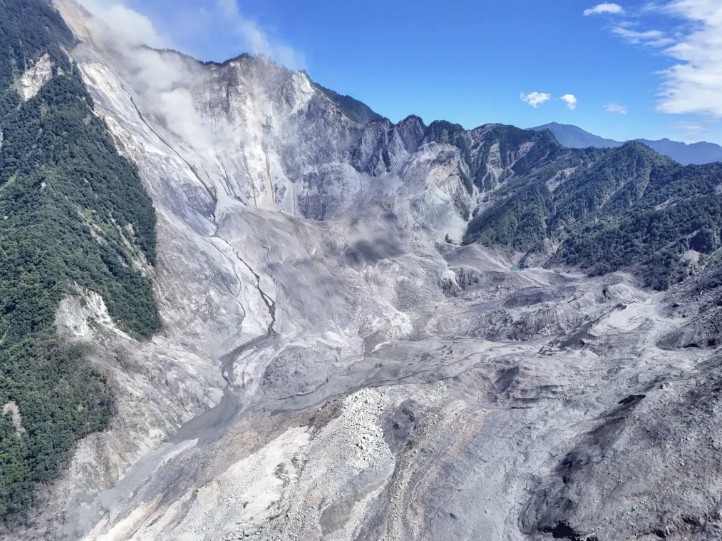
The large source area is clear in the upper left of the image. Note the dust cloud from continued rockfall activity. The initial track of the landslide has left a complex topography that includes bare rock and some landslide material (especially on the right side of the image).
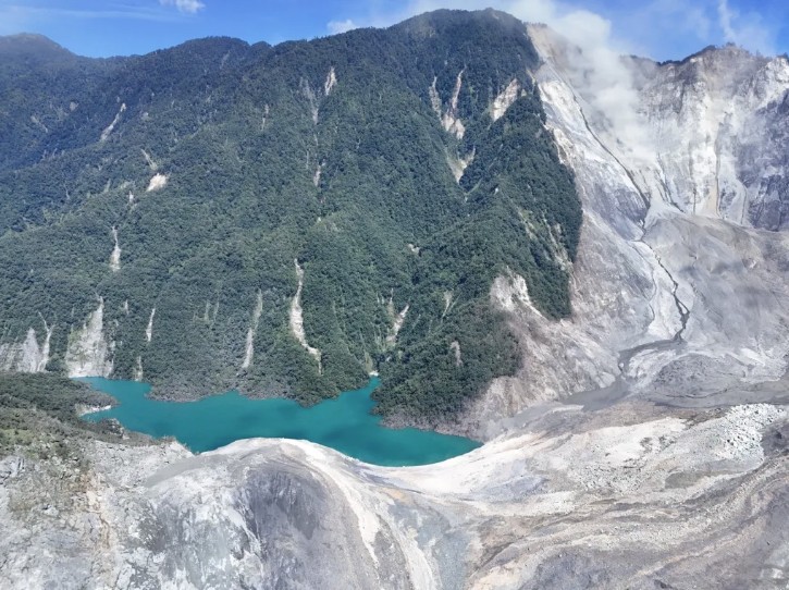
This image captures the lake that is forming:-
Note the very substantial height difference between the lake and the top of the landslide deposit. Given that this valley was free draining before the landslide occurred, this must all be landslide material. As such it is erodable in the event of overtopping.
Finally, this is a view of the whole length of the landslide:-
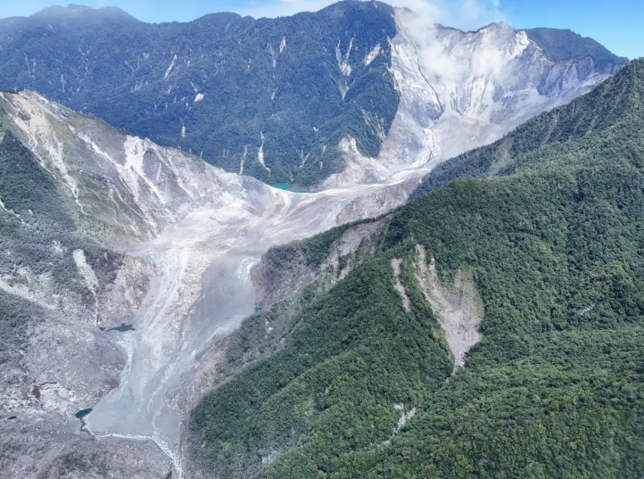
Again, note the height of the saddle formed from landslide material. The deposit appears on first inspection to be steep, which suggests it might be quite erodible.
The etaiwan.news article highlights work being undertaken by the Hualien Branch of the Forestry Conservation Department to understand the hazard. The statistics of the dam are concerning:
| As of 7 August 2025 | At overtopping | |
| Lake volume | 23 million m3 | 86 million m3 |
| Lake length | 1,770 m | 2,900 m |
The current freeboard is 79 m. Current inflow into the lake is 920,000 m3 per day, giving an overtopping date of mid-October at current rates (but see below).
A key issue is then the assets at risk downstream. This is a Google Earth image of the channel entering the Longitudinal Valley:-
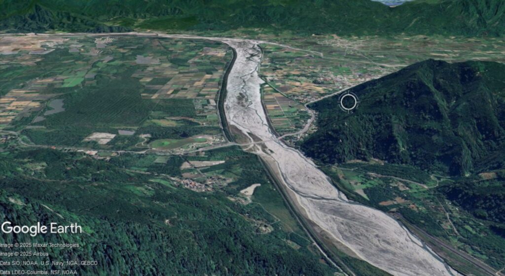
The article mentions that the risk will extend to:-
“will include the Matai’an Creek Bridge on the downstream Taiwan Line 9 [this is main highway on the eastern side of Taiwan], public and private river defence facilities and settlements on both sides of the river, and the administrative area covers Mingli Village, Dama Village, Daping Village, Dongfu Village in Wanrong Township, and Changqiaoli, Darongli and Shanxingli in Fenglin Township.”
Taiwan is well-placed to manage this hazard, but it is going to be a major issue in the coming weeks. Finally, as noted above, the overtopping date is estimated from current inflow rates. But, the next few weeks are the peak of the typhoon season, which can bring exceptional rainfall.
And, right on cue, Tropical Storm Podul has formed to the east of Taiwan, and is now moving westward. It is too early to tell whether this will bring heavy rainfall to the Matia’an valley (it is likely to pass by Taiwan on about 13 – 14 August), but if it does then this will accelerate the filling of the lake. Even if it does not bring heavy rainfall, the development of another typhoon that affects this area in the next two months would not be a surprise.
Text © 2023. The authors. CC BY-NC-ND 3.0
Except where otherwise noted, images are subject to copyright. Any reuse without express permission from the copyright owner is prohibited.