Editors’ Vox is a blog from AGU’s Publications Department.
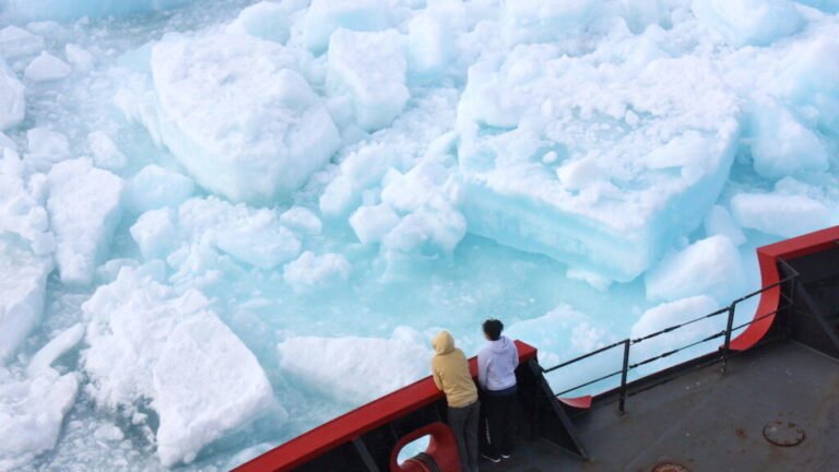
Ice sheets can have a large impact on the surrounding land and sea where they form, which can create many different landforms. One such landform is called a “glacial forebulge,” which is a long hill that forms in front of an ice sheet. These glacial forebulges are important to understand since they influence sea level and earthquake activity in North America and Europe.
A new article in Reviews of Geophysics digs deeper into the characterization of glacial forebulge dynamics. Here, we asked the authors to give an overview of glacial forebulges, how scientists study them, and what questions remain.
How would you define a glacial forebulge to a non-specialist?
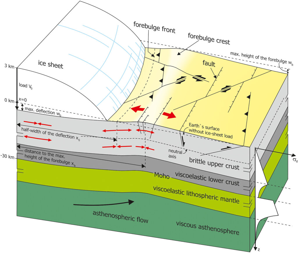
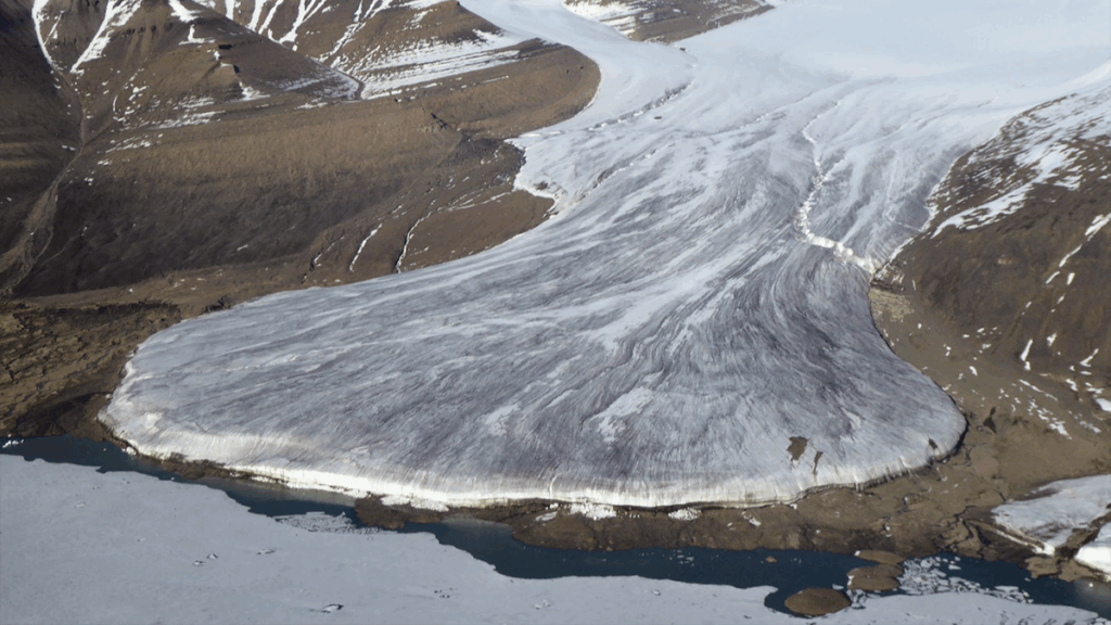
A glacial forebulge is an upheaval of the Earth’s surface that is formed in front of an ice sheet and runs parallel to the ice margin. These form because the ice mass bends the lithosphere and deforms the Earth’s surface. Below the ice load, a depression is formed, whereas outside the ice sheet, there is a gentle upward bending of the surface that forms the forebulge. This bending is supported by Earth’s lithosphere and mantle material that flows away from the area pushed down by the ice sheet.
For the large ice sheets that covered northern Europe and North America during the last glacial period, state-of-the-art numerical models show that the crest, or the highest point, of the forebulge has a maximum height of approximately 50 meters and 90 meters in these areas, respectively. Additionally, the crest can be one or two hundred kilometers away from the ice margin’s maximum extent around 20,000 years ago.
Why is it important to understand glacial forebulges?
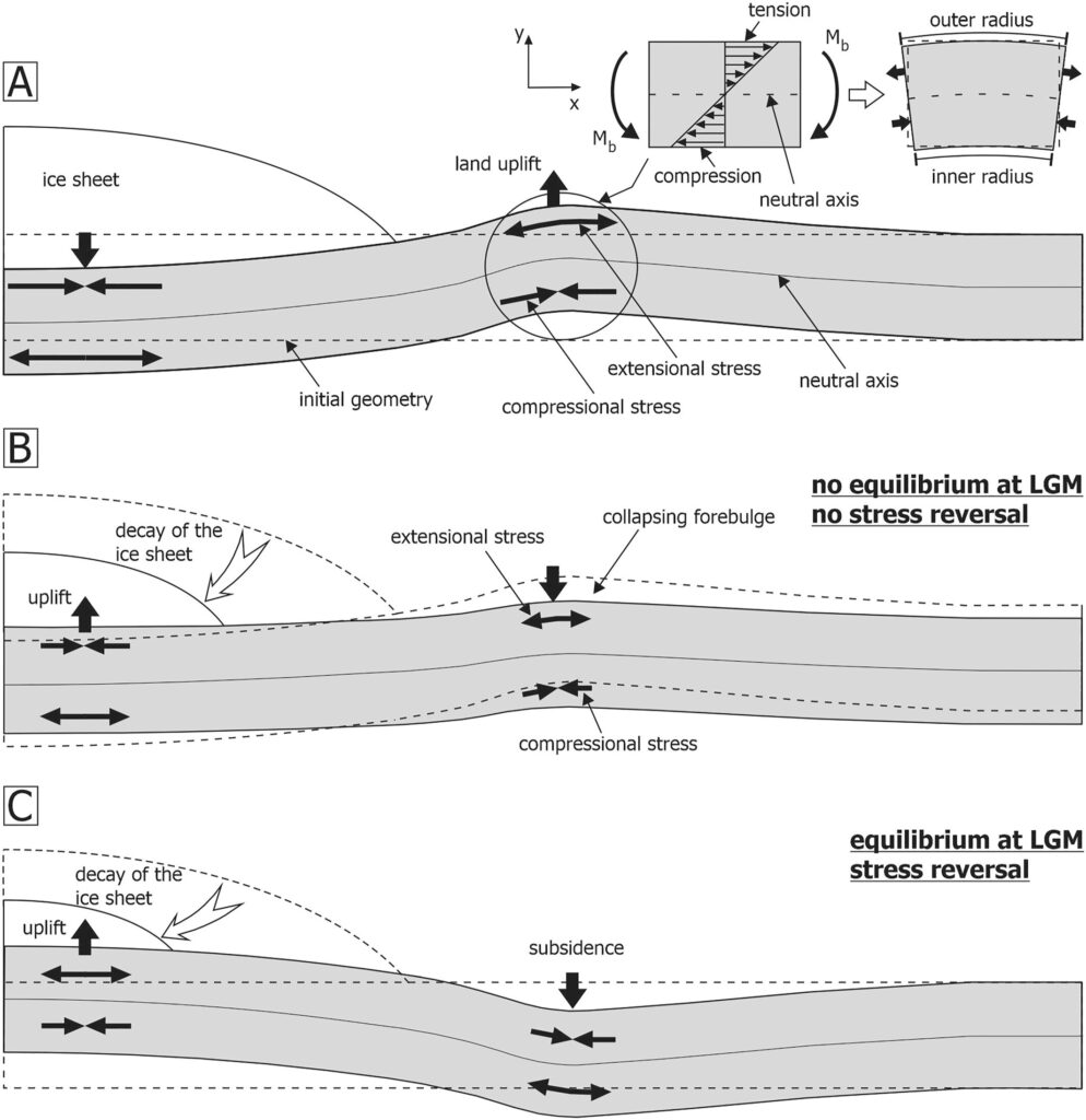
The formation, geometry, and motion of the glacial forebulge affects sea level, river flow paths, and earthquake activity in North America and Europe. Though the large ice sheet of the last glaciation is already gone, remnants of the forebulge still exist. With the ice load gone, the area that was below the ice is uplifting and, consequently, the area of the forebulge now subsides. This process is slow and still ongoing, because the lithosphere cannot move independently from the underlying mantle. The mantle has a high viscosity and flows slowly. The subsidence in the forebulge area is on the order of a few millimeters per year. At coastlines, this subsidence can result in a rising sea level. The subsidence of the forebulge area also changes the stress state of the lithosphere, which could lead to a reactivation of pre-existing faults that can cause earthquakes.
How do scientists observe and measure glacial forebulges?
In the early years of forebulge research, the existence of a glacial forebulge was predicted by theoretical considerations and calculations assuming that the Earth’s surface before the onset of glaciation was “more-or-less flat,” and the deformation was due to the loading and unloading of a single ice sheet. These models were used to interpret the observed relative sea level data in the near field of the ice centers in Northern Europe and North America. In particular, these correspond to a transition zone between a zone showing pure land emergence and a zone showing pure land submergence in the pattern of global sea level change. These zones are carefully explained in our study.
How have these methods evolved over time?
Today, high-quality sea level data are used in the study of glacial forebulges and the numerical models used to simulate Earth deformation and relative sea level change are more refined and realistic. For example, the change in ice-thickness history and the migration of ice margins for all the globally important ice sheets and their interactions on Earth deformation are included. Earth material properties can now change both radially and laterally. Mantle flow-law can be linear, nonlinear, and composite.
In the computation of sea level change, effects such as time-dependent coastlines (land-sea boundaries that change geographically over time) and rotational feedback (the concept that the redistribution of Earth’s surface and internal mass can change its rotational or spin motion and thus sea levels) are included. Besides sea level data, other measurements from modern geodetic techniques are also used. For example, forebulge decay is inferred from the Global Navigation Satellite System (GNSS).
What are some of the major controlling factors of glacial forebulge behavior/evolution?
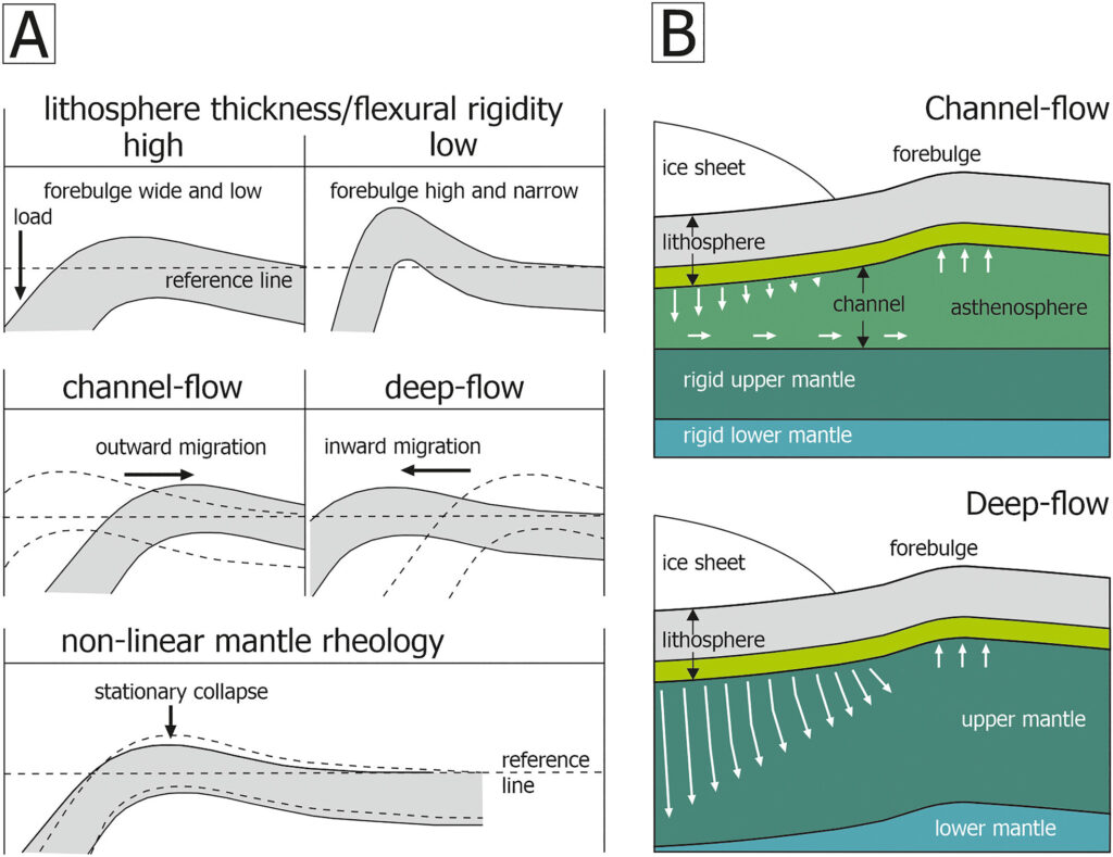
The most important controlling factors for the geometry and behavior of a glacial forebulge are the structure and material properties of the lithosphere and the viscosity, as well as the flow pattern, in the underlying mantle (including the asthenosphere). A thick and rigid lithosphere leads to a lower forebulge crest that is located at a greater distance from the ice margin. If the lithosphere is thinner and less rigid, the forebulge crest is higher and lies closer to the ice margin. In addition, the forebulge can migrate through time. The flow behavior of the material in the mantle determines how the forebulge migrates when the ice sheet decays. When the ice melts, the forebulge can either retreat with the ice margin, move away from the ice margin, or decay in place.
What are some of the recent advances in our understanding of glacial forebulges?
GNSS data have allowed researchers to map the position of the now decaying forebulge with a higher accuracy. GNSS data for North America and Europe show that there is a belt of subsidence parallel to the former ice margin. This subsiding area is the decaying forebulge.
In North America, it can be found in the southern parts of the central Canadian provinces and the northern United States, making a north-east turn just south of the Great Lakes, then following the northeastern US east coast states into the Maritimes. In Central Europe, there is a subsidence zone that runs from the Netherlands across northern Germany into Poland and southern Lithuania.
This knowledge about today’s forebulge behavior can help to better predict future sea level positions along the US east coast and the coasts of northern Central Europe, the Baltic countries and southern Scandinavia.
What are the major unsolved or unresolved questions and where are additional research, data, or modeling efforts needed?
Because of its small magnitude today, the forebulge in Europe is difficult to observe. Moreover, there are overlapping processes from sediment compaction and large-scale tectonics that hamper a clear determination with geodetic techniques in northern Central Europe. In northeastern Europe, the forebulge cannot be traced yet because of insufficient geodetic data.
To solve these questions, more high-quality data and improved modeling of glacial isostatic adjustment are needed. An integrated study should interpret all the observations and modeling results related to the glacial forebulge (including, for example, height and direction of bulge movement, uplift pattern, relative sea level changes, stress changes and seismicity, etc.) to get a more coherent view of the glacial forebulge dynamics. Precise terrestrial GNSS measurements and satellite data should be utilized to enhance the understanding of forebulge evolution and help to distinguish its subsidence signal from the subsidence caused by groundwater extraction or natural gas recovery.
—Christian Brandes (brandes@geowi.uni-hannover.de, ![]() 0000-0003-2908-9259), Leibniz Universität Hannover, Germany; Holger Steffen (
0000-0003-2908-9259), Leibniz Universität Hannover, Germany; Holger Steffen (![]() 0000-0001-6682-6209), Lantmäteriet, Sweden; Rebekka Steffen (
0000-0001-6682-6209), Lantmäteriet, Sweden; Rebekka Steffen (![]() 0000-0003-4739-066X), Lantmäteriet, Sweden; Tanghua Li (
0000-0003-4739-066X), Lantmäteriet, Sweden; Tanghua Li (![]() 0000-0003-0501-0155), Nanyang Technological University, Singapore; and Patrick Wu (
0000-0003-0501-0155), Nanyang Technological University, Singapore; and Patrick Wu (![]() 0000-0001-5812-4928), University of Calgary, Canada
0000-0001-5812-4928), University of Calgary, Canada
Citation: Brandes, C., H. Steffen, R. Steffen, T. Li, and P. Wu (2025), How glacial forebulges shape the seas and shake the earth, Eos, 106, https://doi.org/10.1029/2025EO255030. Published on 23 September 2025.
This article does not represent the opinion of AGU, Eos, or any of its affiliates. It is solely the opinion of the author(s).
Text © 2025. The authors. CC BY-NC-ND 3.0
Except where otherwise noted, images are subject to copyright. Any reuse without express permission from the copyright owner is prohibited.