The independent watchdog is conducting at least 39 investigations into whether the Trump administration violated the Impoundment...
Science
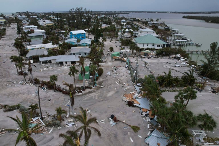
Of the six to 10 hurricanes NOAA projected for this year, three to five of them could...

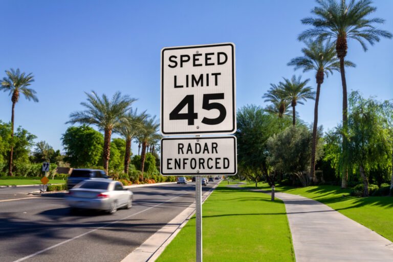
The upcoming Atlantic hurricane season will likely have above-normal activity, according to the annual outlook produced by...
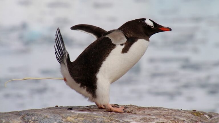
Ammonia released from penguin poop helps produce cloud-seeding aerosols in Antarctica, which can affect local climate by...

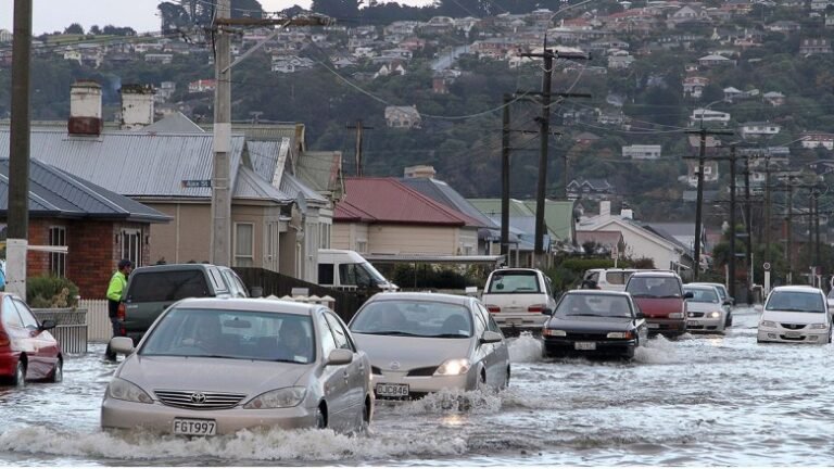
As a candidate, the president spread misinformation about the Hurricane Helene recovery efforts, convincing many survivors that...

Research & Developments is a blog for brief updates that provide context for the flurry of news regarding...

Eos is welcoming June (that’s National Ocean Month in the United States) with a rhyming tradition of...

Editors’ Highlights are summaries of recent papers by AGU’s journal editors. Source: Journal of Geophysical Research: Solid...
The Landslide Blog is written by Dave Petley, who is widely recognized as a world leader in...
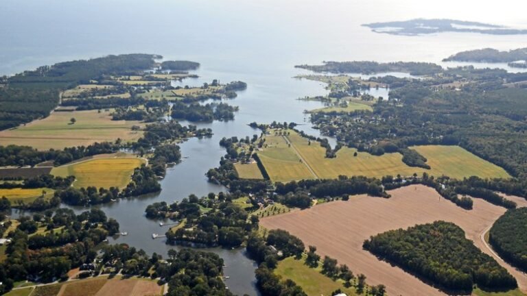
Source: AGU Advances The Chesapeake Bay is the continental United States’ largest estuary, spanning approximately 320 kilometers...

Frank Marks remembers the Diet Coke can floating in front of his face as the plane pitched...
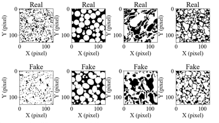
Editors’ Highlights are summaries of recent papers by AGU’s journal editors. Source: Water Resources Research Rocks are...

The Landslide Blog is written by Dave Petley, who is widely recognised as a world leader in...

Research & Developments is a blog for brief updates that provide context for the flurry of news regarding...
Source: Earth’s Future This is an authorized translation of an Eos article. 本文是Eos文章的授权翻译。 随着气候变化持续推动全球海平面上升,许多生活在沿海地区的居民已感受到其影响。海岸侵蚀正在加速,海岸线向内陆移动,风暴潮也愈演愈烈。但隐藏在地表之下的还有另一个迄今为止鲜为人知的严重后果:地下水位上升。 有证据表明,在一些地势低洼、地下水位较浅的沿海地区,海平面上升将导致地下水位同步上升,这可能会给住宅、企业和其他基础设施带来严重风险。 在一篇聚焦新西兰沿海城市达尼丁的新论文中,Cox等人展示了一种预测海平面上升如何改变地下水位,从而增加内陆洪涝灾害的方法。达尼丁南部已经经历了周期性洪涝灾害,随着海平面上升,洪涝灾害将变得更加严峻。研究人员将该城市描述为新西兰社区应对和适应气候变化和海平面上升的典范。 研究人员使用了2019年至2023年的数据,这些数据来自安装在达尼丁低洼沿海地区的35个地下水传感器网络,该市的大部分基础设施都位于该区域。他们将传感器数据与潮汐、降雨和其他因素的数据进行比较,来预测未来海平面上升对地下水的影响。 研究结果表明,海平面上升首先会导致地下水位上升,从而降低土地吸收降雨的能力。随着海平面继续上升,地下水位可能会进一步上升,并在地下水位以下造成问题,例如淹没污水处理系统、渗入地下室以及破坏建筑物地基。最终,地下水可能会上升到足够高的地方,形成泉水,引发洪水。 研究人员得出结论,地下水位上升造成的洪水灾害可能向内陆延伸到比许多人预期的更远的地方。此外,假设达尼丁沙丘屏障的防护地形不发生重大变化,这些地下水效应将比海平面上升直接造成的洪水更早发生。 研究人员指出,他们的方法包含关键的假设和不确定性——例如,地下水和海平面将以相同的速度上升,地下水位将保持大致相同的形状,但保守的预测对于达尼丁的规划和灾害管理具有重要价值。他们表示,由于该方法相对简单且成本低廉,因此也可以应用到世界各地类似的沿海地区。...

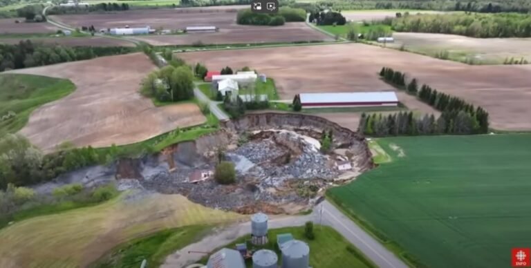
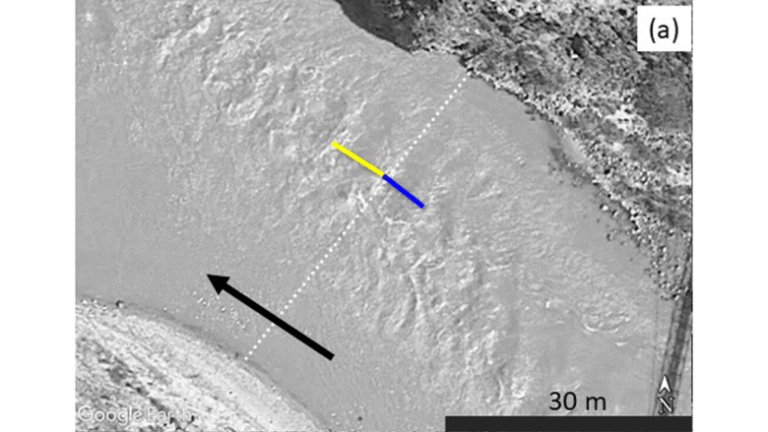
For decades, wounds have surfaced in the Peruvian Amazon where the Rio Inambari merges with the Rio...

Source: Geophysical Research Letters Artificial intelligence (AI) algorithms can produce weather predictions more quickly than traditional algorithms...
Editors’ Highlights are summaries of recent papers by AGU’s journal editors. Source: Geophysical Research Letters River discharge...
The Landslide Blog is written by Dave Petley, who is widely recognized as a world leader in...

Efforts to preserve Biden-era tax breaks for green technology are running into an administration focused on fossil...