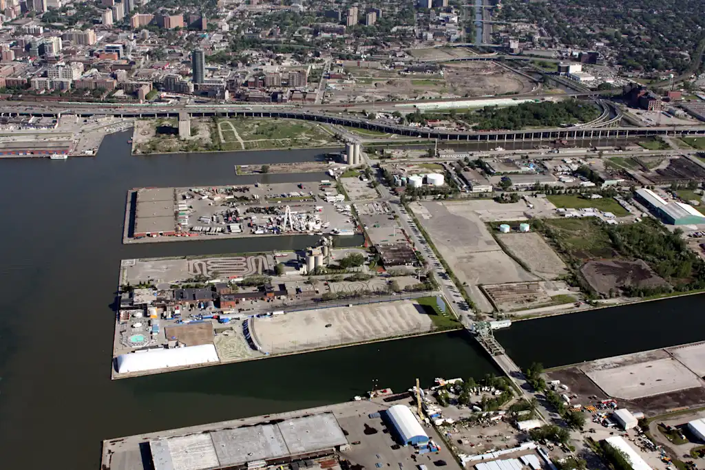
For more than a century, a stretch of riverfront in Toronto was an industrial wasteland, with oil storage tanks, factories, and shipping infrastructure sitting on former wetlands. Now, part of the site is a sprawling new park, and next year, construction will begin on a new neighborhood inside it.
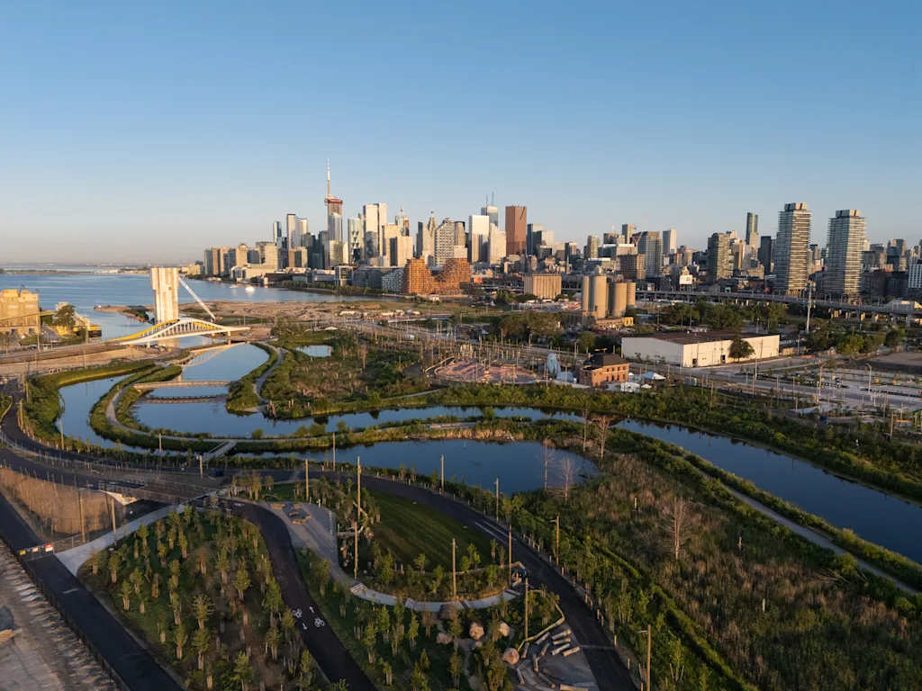
“It’s incredibly transformed,” says Emily Mueller De Celis, a landscape architect at the firm Michael Van Valkenburgh Associates, which won a competition to “renaturalize” the area in 2007. “Rather than walking around in and amongst oil refineries and other industry, now you are immersed in nature, walking along the banks of a river with spectacular views back to the city.”
The area was dotted with factories in the late 1800s. The river was dredged and corralled into a channel as the city tried to flush pollution from the factories into the nearby harbor. By the early 1900s, the wetlands in the area—now overrun with toxic waste—were filled in to build a new industrial district. Pollution kept getting worse.
The changes to the river also caused new flooding. By the 1980s, activists were calling for the restoration of the river. By the early 2000s, the government launched an effort called Waterfront Toronto to revitalize the area and create new flood protection, and it started to demolish some of the old industrial infrastructure.
The scale of the $1.4 billion project, along with inevitable delays, meant that it’s taken a very long time. “This is the largest infrastructure project in North America,” says Mueller De Celis. The project carved out more than 1.3 million cubic meters of soil, reshaping a new mouth for the river and creating a new island where the park, called Biidaasige Park, now sits. The design helps protect adjacent areas from flooding.
From the beginning, Waterfront Toronto wanted to use green infrastructure for flood protection. “They had the vision to identify that this wasn’t going to be an engineering solution,” Mueller De Celis says. “It would be a solution that really tied us back into the naturalized system of the [river] valley, and into the public realm to get people access to nature.”
The excavated river is now deeper and surrounded by new wetlands where the water can spread, with berms that help hold water back from other neighborhoods. The island where the park sits was built high enough to avoid flooding.
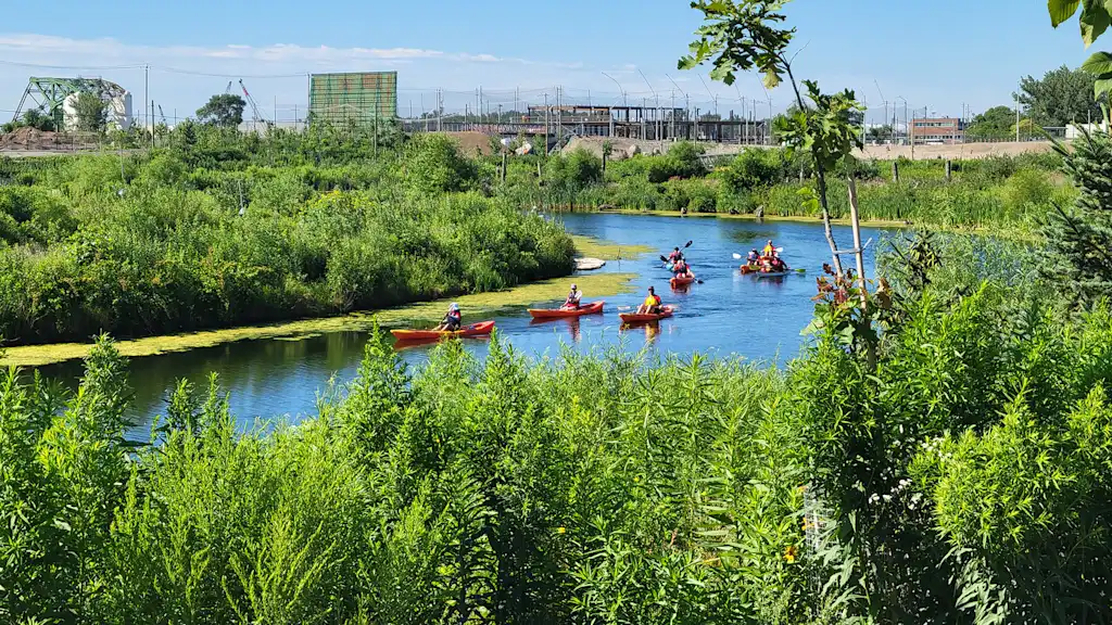
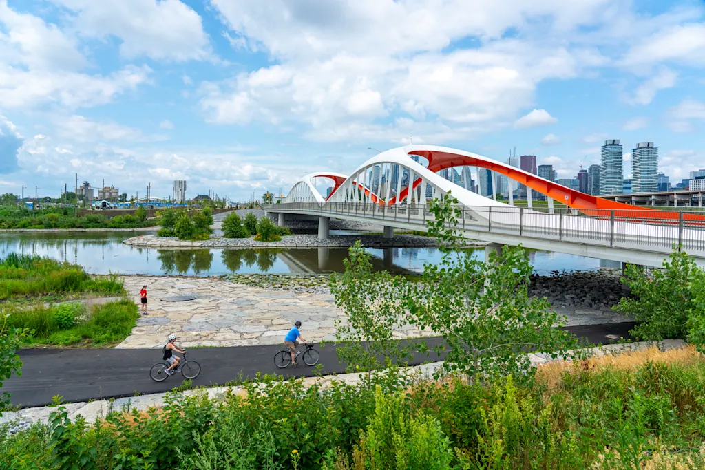
A coalition of partners working on the project carefully designed the park to help bring back wildlife to the area. The park is filled with trees that will eventually form a canopy forest. Along the edge of the river, where engineers might typically use stone or concrete, the team brought in large trees and locked them together in a pattern that helps prevent erosion—and creates new “fish hotels” in the empty spaces as habitat. Other felled trees were laid down hanging over the water to add more new space for amphibians, fish, and birds. Red-tailed hawks, eagles, and otters have returned.
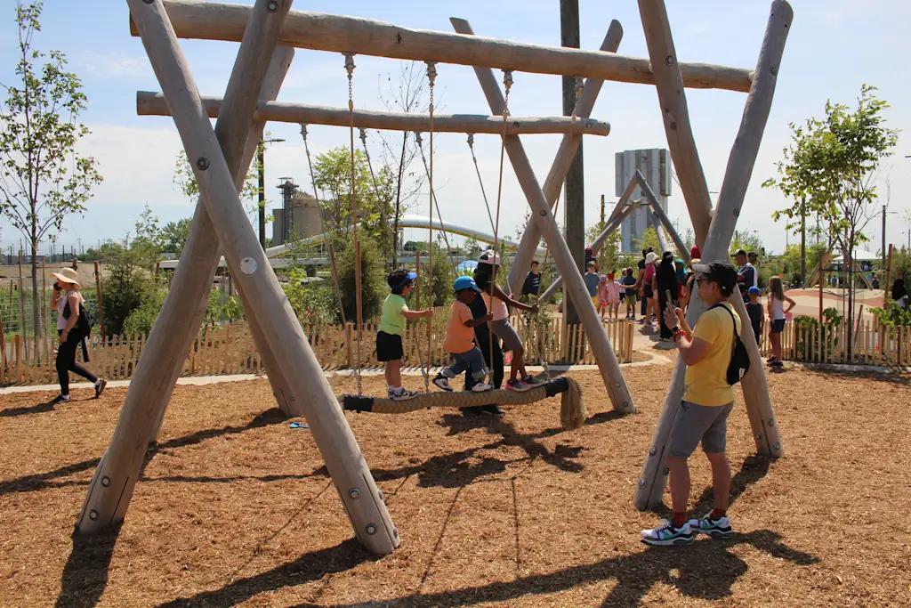
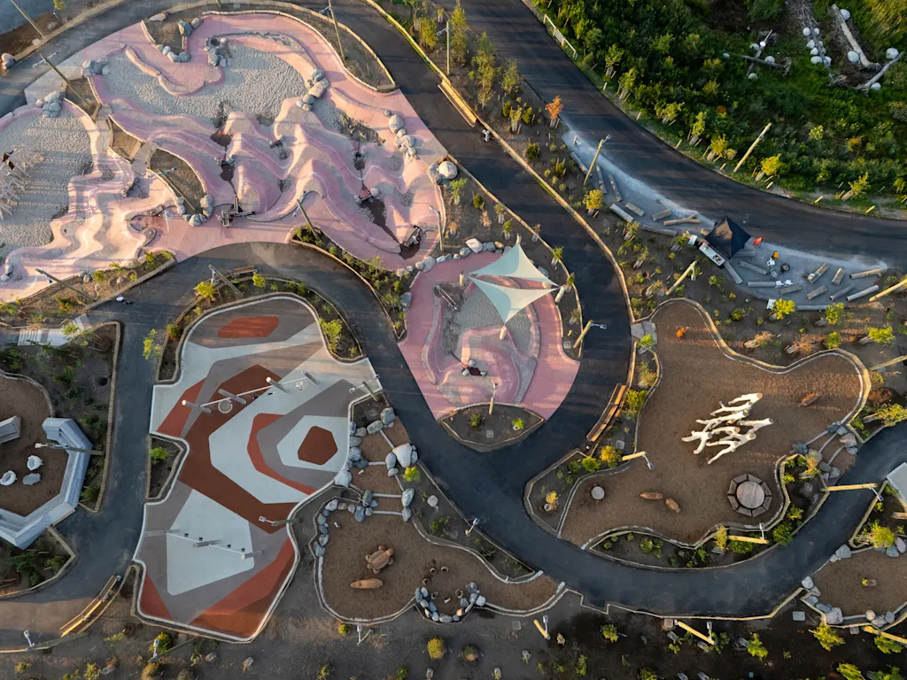
This summer, the first phase of the park opened to the public, and the next phase will open in 2026. The park surrounds the new island, and the center will soon become a mixed-use development. Design work started this year on streets and infrastructure, and construction of new homes is expected to begin next year. Eventually, the island will be home to 15,000 residents, 3,000 jobs, and another 15 acres of park space.
Nearly a decade ago, Alphabet’s Sidewalk Labs, a subsidiary focused on urban technology, hoped to build a smart city along a nearby part of the waterfront. But it abandoned the project in 2020. Toronto is now focused on using the whole area to help deal with its housing shortage. At the beginning of 2025, the Canadian government, along with the city and provincial governments, invested another $975 million to build new housing on the waterfront.
The park and redesigned river had to come first, to make sure any new development would be protected from floods. “It’s a different way of thinking about building within a city,” Mueller De Celis says.