Editors’ Highlights are summaries of recent papers by AGU’s journal editors.
Source: AGU Advances
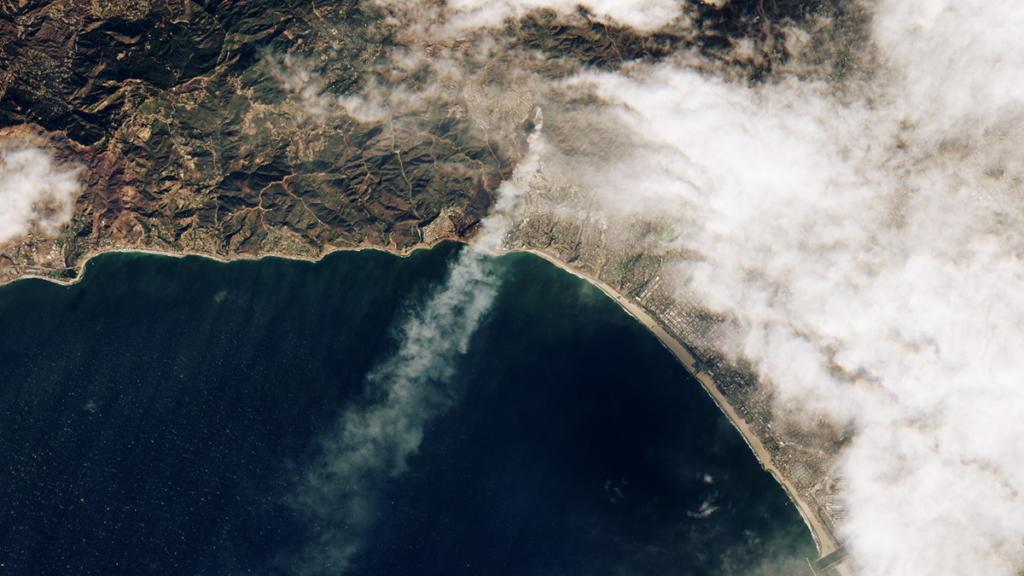
In January 2025, a series of devastating wildfires swept through Los Angeles, causing widespread and catastrophic damage to critical infrastructure, displacing entire communities, and inflicting severe harm on the surrounding environment.
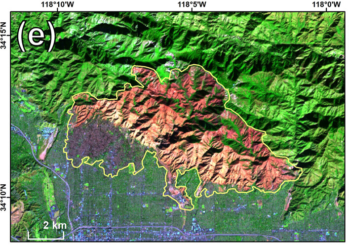
By leveraging fire and emissions observations from remote satellites, Li et al. [2026] document the fire spread thus revealing how the fire moved after ignition and reached the urban settlements. In particular, the timing of the fire spread provides innovative information and supports the development of management strategies to cope with analogous future events. Interestingly, the authors found that residential fires released less carbon monoxide (CO) emissions per unit of radiative energy with respect to vegetation fires. The authors conclude that the observed dynamics of fire emissions and their linkage to fire intensity by new satellites open new opportunities to improve air quality forecasting.
Citation: Li, F., Zhang, X., Cochrane, M., Kondragunta, S., & An, S. (2026). Fire spread, intensity, and emissions observations by multiple satellites: The southern California wildfires of January 2025. AGU Advances, 7, e2025AV002064. https://doi.org/10.1029/2025AV002064
—Alberto Montanari, Editor-in-Chief, AGU Advances
Text © 2026. The authors. CC BY-NC-ND 3.0
Except where otherwise noted, images are subject to copyright. Any reuse without express permission from the copyright owner is prohibited.