A large landslide in Tkibuli municipality has rendered 45 families homeless and has caused damage over an area of 58 hectares.

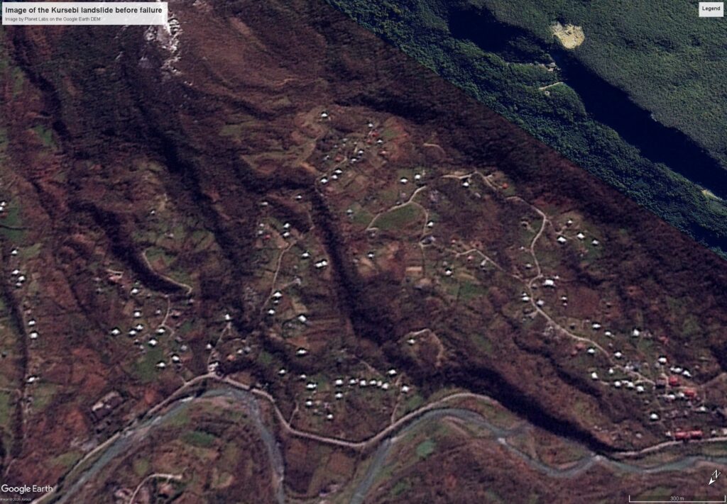
Early in the morning of 12 March 2026, a landslide struck a small village in Tkibuli municipality of rural Georgia. The Kursebi landslide has rendered 45 families homeless, causing damage over a surface area of about 58 hectares. At least ten houses have been completely destroyed. The location of the landslide is [42.30907, 42.79007].
There is a very good article about this landslide on the OC Media website and there is a video of some images of the aftermath of the landslide on Youtube:-
This image shows a Planet Labs image from 10 March 2026 of the site of the Kursebi landslide prior to failure:-
Whilst this image, from 18 March 2026, shows the same location after the failure:-
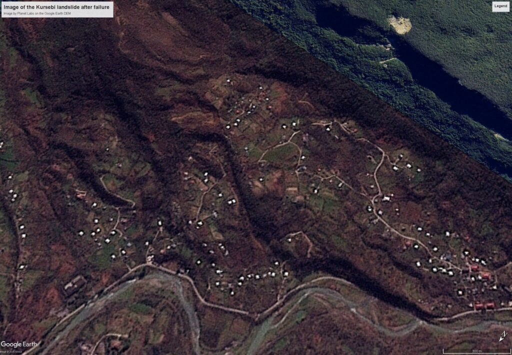
And here is a slider to allow comparison of the images:-


Note the displacement of the terrain and the buildings and the tension cracks at the crown of the landslide, and the damaged road at the toe. It appears that the houses directly affected by the landslide will be permanently lost.
I think the existence of this landslide was evident in the imagery prior to failure, and I wonder whether that large river bend at the toe might indicate an earlier failure event?
Acknowledgement
Many thanks to the wonderful people at Planet Labs for making the imagery available to me.
Text © 2026. The authors. CC BY-NC-ND 3.0
Except where otherwise noted, images are subject to copyright. Any reuse without express permission from the copyright owner is prohibited.