Good digital data is now being published that presents the scale of landscape change that occurred as a result of the Matai’an landslide hazard cascade. There is also interesting information about the root causes of the vulnerability of the town of Guangfu, where the fatalities occurred.

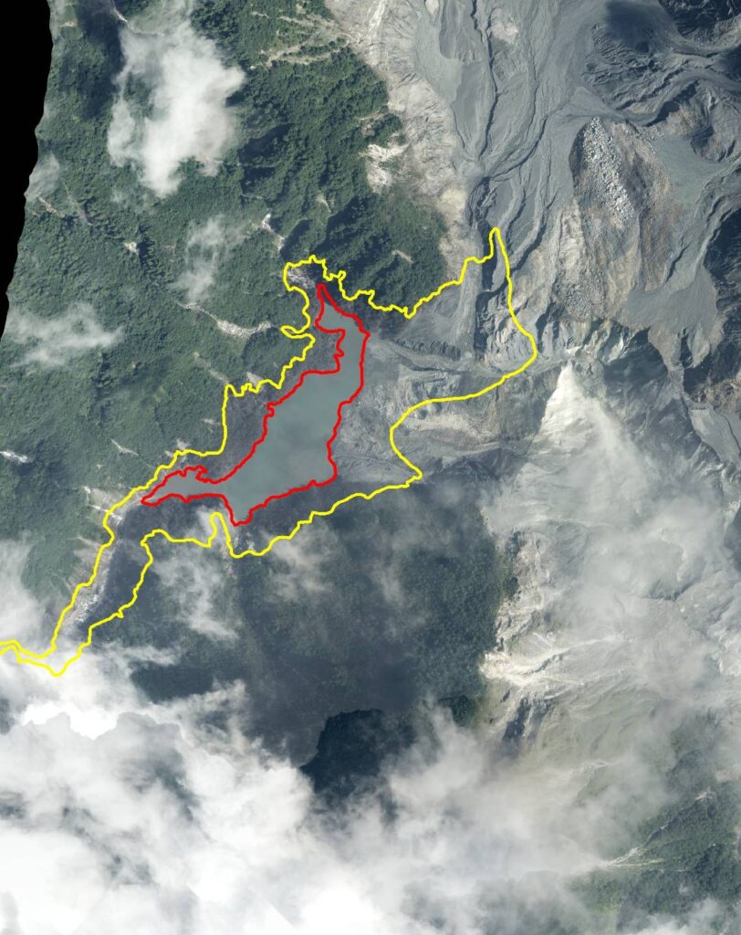
Some interesting information is now emerging about the Matai’an landslide and dam breach, much of it published in Taiwan in Mandarin. A very interesting post has appeared on the website of the Aerial Survey and Remote Sensing Branch that uses aerial imagery before and after the hazard cascade to analyse terrain changes. It is based upon this figure that they have published:-
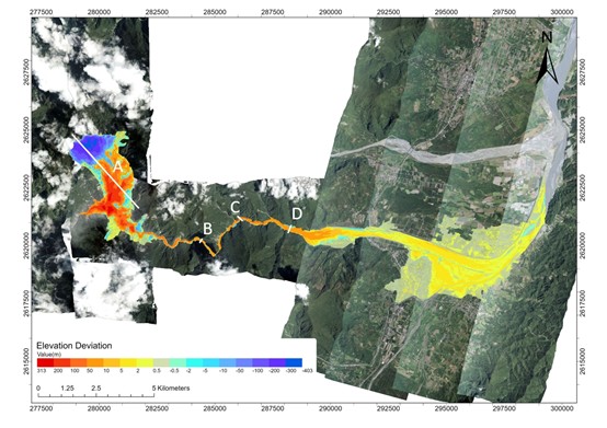
This uses LIDAR data from before and after the sequence of events, which has been turned into one metre Digital Elevation Model, which have then been digitally compared. Note this gives vertical change.
In the source area of the landslide, where the topography is extremely steep, there is over 300 metres of elevation reduction. Downslope and in the area of the dam and lake, the elevation change is over 200 m of accumulation – this is the landslide debris, whivch will now be mobilised in successive rain storm events. In the main channel, the river bed has aggraded (increased in elevation) by over ten metres, although the analysis shows that at point C this was 52 metres! This is going to cause very substantial issues in the future unless a large scale mitigation exercise is undertaken.
The cross-section through the landslide is fascinating:-
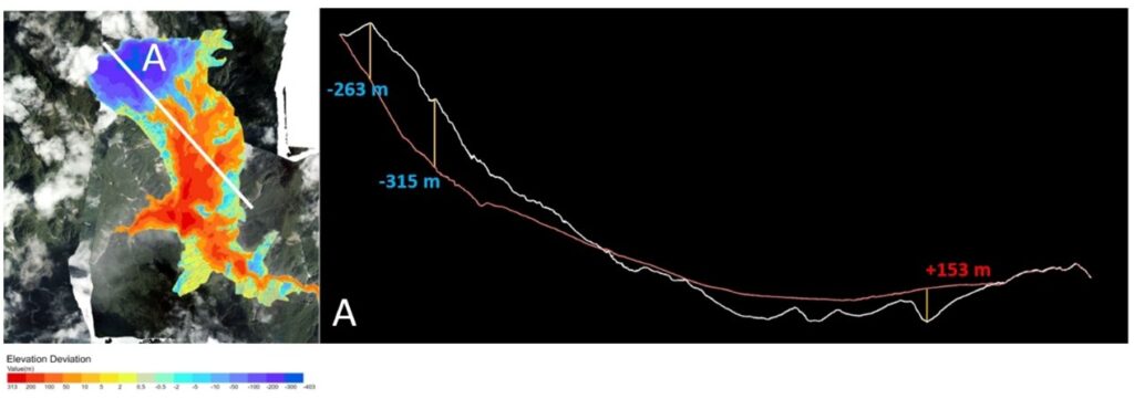
This shows extremely well the rupture surface of the failure, which clearly had a rotational element, and the infilling of the bedrock topography by the landslide debris. Meanwhile, there is a good helicopter video on Facebook that shows the aftermath of the dam breach.
On a different matter, there is a huge amount of discussion in Taiwan as to why so little effort was made to mitigate the hazard associated with a breach of the Matai-an landslide dam. Writing in the Taipei Times, Michael Turton has a great article exploring the socio-political reasons why this disaster played out as it did. The bottom line is that Guangfu was built on a floodplain – a problem in so many places, but particularly acute in the almost uniquely dynamic physical geography of Taiwan. Levees were built to protect the town, which caused the river to aggrade even before the dam break event. And thus, the scene was set.
Hazards can be natural, disasters are not.
Text © 2023. The authors. CC BY-NC-ND 3.0
Except where otherwise noted, images are subject to copyright. Any reuse without express permission from the copyright owner is prohibited.