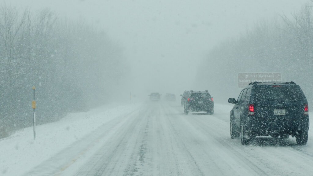
A late-season winter storm is delivering a punishing mix of snow, sleet and freezing rain across Wisconsin and Michigan’s Upper Peninsula, prompting Ice Storm Warnings, Winter Storm Warnings and Winter Weather Advisories from multiple National Weather Service offices. The Weather Prediction Center is tracking the system as the first of back-to-back significant late-season storms, with ice accumulations up to 0.4 inches, snow totals reaching 4 inches in the Keweenaw Peninsula and wind gusts hitting 40 MPH. Hazardous conditions extend from I-94 in western Wisconsin north through the UP, with a second wave arriving Friday night ahead of Easter weekend.
What to Expect
The heaviest snow and sleet totals, 2 to 4 inches, are falling across the Keweenaw Peninsula and Houghton and Ontonagon counties, according to NWS Marquette. Baraga and Marquette counties are seeing 1 to 3 inches of snow and sleet combined with ice accumulations up to a quarter inch, while winds gust to 35 MPH.
Farther south, ice is the dominant hazard. NWS Green Bay reports ice accumulations between 0.2 and 0.4 inches across central and north-central Wisconsin, including Marathon, Portage, Wood, Waupaca, Lincoln and Langlade counties, where Ice Storm Warnings are in effect. The NWS notes that this type of warning is rare in Wisconsin, typically issued only once every 4 to 5 years.
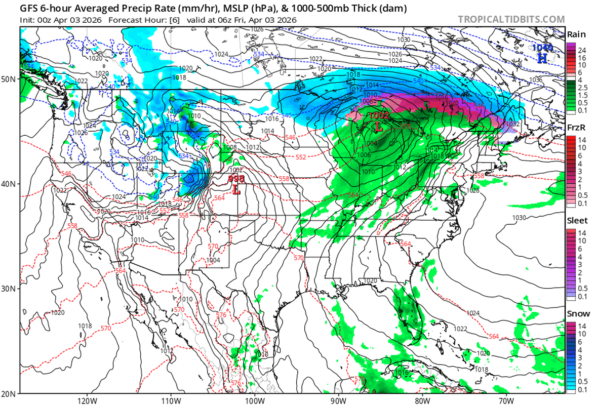
Along I-94 in western Wisconsin, the NWS Twin Cities/Chanhassen office warns the greatest icing is forecast along and north of the interstate, with a quarter to nearly half an inch possible in isolated spots. Drivers on US-2 and US-41 through the UP should expect slippery, snow-covered surfaces through Friday morning. I-41 through the Fox Valley and I-43 along the Lake Michigan shore have been affected by freezing rain and sleet, reducing visibility and traction since early Thursday.
Road Conditions
Icy roads have already turned fatal. At least one person died in a crash on I-43 in Wisconsin caused by icy conditions during the Thursday morning commute. The NWS is strongly discouraging travel across much of central and northern Wisconsin, where conditions are described as “nearly impossible” in Price County.
Bridges and overpasses along I-41, US-141 and secondary roads through northern Wisconsin are especially treacherous because thin ice accumulations reduce stopping ability far more than drivers expect. Rural roads north of US-8 are at high risk for drifting sleet and localized ice buildup, reducing some stretches to single-lane travel. Check 511wi.gov for Wisconsin road conditions and Michigan’s MI Drive for the UP before committing to any drive.
Power Outages & the Second Wave Before Easter
We Energies and Wisconsin Public Service crews are already restoring outages from the first round of icing, and UPPCO has staged crews across the Upper Peninsula. The concern is what comes next. The Weather Prediction Center has confirmed a second system will arrive Friday night through Saturday morning, and NWS Marquette has issued Winter Storm Watches across nearly every UP county for this wave, with ice accumulations up to 0.4 inches possible. NWS Green Bay has posted Winter Storm Watches across northern Wisconsin as well.
This second round of icing could be worse than the first in areas like Baraga and Marquette counties, where 0.2 to 0.4 inches of new ice would load onto lines and limbs already stressed by the initial storm. The timing, arriving Friday evening and persisting through Saturday morning, puts Easter weekend travel directly in its path for anyone heading north on I-41 or US-41.
Winter Driving Tips
Ice is the most deceptive road hazard because it forms with no visible warning. Bridges and overpasses along I-41, I-43 and US-2 freeze before adjacent pavement, and even a tenth of an inch of accumulation makes stopping nearly impossible. All-wheel drive helps you get moving but does nothing to shorten braking distance on ice. Review best practices for driving in snow, ice and rain before heading into the warning area.
With a second wave arriving Friday night before surfaces fully recover, fresh ice will form on top of treated roads, creating a compounding, layered hazard that catches even experienced winter drivers off guard. Check your tire pressure before heading out, make sure your vehicle is winter-ready and keep a fully stocked emergency kit in the car, including a phone charger and flashlight, especially with active power outages across the region.
Drivers heading north for Easter are better off waiting until Saturday afternoon, when road crews will have had time to treat and conditions are expected to improve as temperatures climb above freezing.
Timing
The first system exits early Friday morning. The second wave moves in on Friday evening and persists through Saturday morning before tapering off by midday Saturday. Overnight refreezing Saturday night remains a risk on untreated surfaces. For Easter Sunday travel, watch for icy patches on bridges and shaded stretches during the early morning hours, and check road conditions before heading out.