
Imagery is now available that shows the aftermath of 3.1 km long landslide that killed about 90 people in West Bandung.

On 24 January 2026, a major landslide occurred on the flanks of Gunung Burangrang (Mount Burangrang) in West Bandung, Indonesia. The search has been long and painstaking, but it is thought that 92 people were killed. There were 23 reported survivors.
AFA Channel has posted some very good drone footage of the landslide to Youtube (excuse the dramatic music and the incorrect headline):-
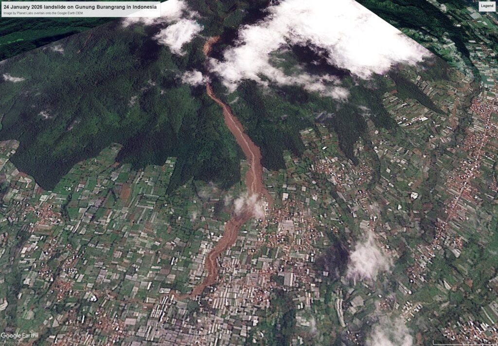
Planet Labs have also captured a good satellite image of the site. I have overlain this onto the Google Earth DEM:-
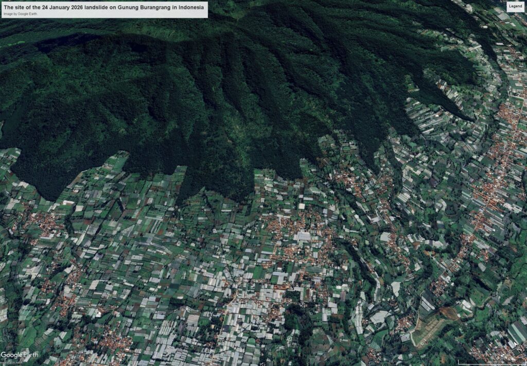
By way of comparison, this is the site prior to the landslide (image from February 2025):-
And here is a slider to allow a comparison between the images:-


This appears to have been a deep-seated, probably structurally-controlled failure on high, very steep slopes of Gunung Burangrang, which has then transitioned into a channelised flow. There is considerable entrainment along the track. The landslide is about 3.1 km long and up to 150 m wide.
There has been considerable discussion in Indonesia about the role of logging and mining in the causation of these large landslide events, but in this case neither are apparent in the source area. Institut Teknologi Bandung has a nice article about causation of this landslide, which notes that the underlying geology is volcanic. Loyal readers of this blog will recognise the frequency with which intense rainfall triggers devastating landslides in volcanic materials.
Acknowledgement
Many thanks to the wonderful people at Planet Labs for providing access to the satellite imagery.
Text © 2026. The authors. CC BY-NC-ND 3.0
Except where otherwise noted, images are subject to copyright. Any reuse without express permission from the copyright owner is prohibited.