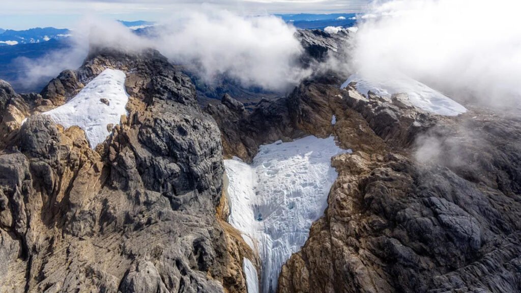
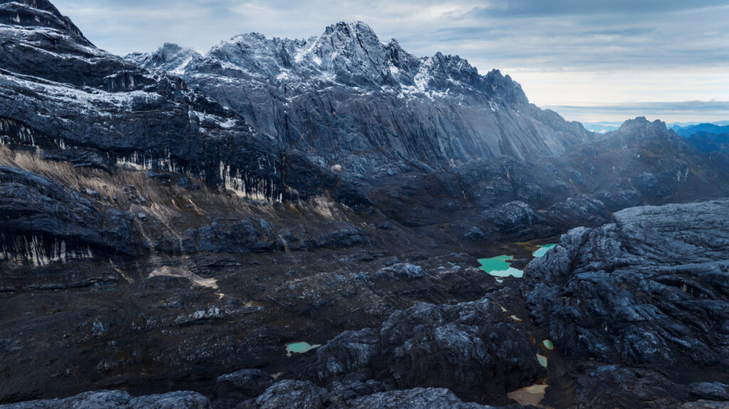
As a child going to school in Timika, Indonesia, the nearest major town to Puncak Jaya, Alion Belau could see, on a clear day, that there were glaciers atop the 4,884-meter (16,024-foot) mountain. Some Indigenous peoples, including Belau’s tribe, the Moni, call them “the eternity glaciers” (or, in Indonesian, Salju Abadi).
Now, as a pilot who flies over Central Papua’s Sudirman mountain range nearly every day, Belau is not seeing as much ice as he used to, even compared to when he first began flying 9 years ago.
“It’s really sad,” he said. “It’s not the eternity iceberg or the eternity glaciers anymore. It’s going to be ‘the 5-year glaciers’ or ‘10-year glaciers.’”
Mapping What Remains
Klaus Thymann, an environmental scientist and explorer, as well as the founder and director of the nonprofit Project Pressure, recently created the first photogrammetry model of the glaciers on Puncak Jaya, aiming to document their current extent and raise awareness about their decline. Photogrammetry uses photography to gain information about the dimensions and location of an environment.
Past research has suggested that in 1850, about 18.8 square kilometers of Puncak Jaya were covered by glaciers. By 2002, that area had shrunk by 88.6%, to 2.14 square kilometers.
According to calculations by the Project Pressure team, the mountain’s East Northwall Firn Glacier had shrunk by 95% since 2002 and is no longer considered a single glacier, but three discrete patches of ice.
Thymann has long been interested in documenting “white spots on the map,” or areas with little data. But he’s been particularly interested in equatorial glaciers. In 2024, he and a team of dozens trekked up Uganda’s Rwenzori Mountains to document the decline of glaciers on Mount Stanley.
“We think of palm trees, and furry animals, and warmth, and exotic fruit when we talk about the tropics, not ice,” Thymann said. “The [idea of] tropical glaciers is hugely fascinating.”
They aren’t just fascinating to people from other countries. Belau said one reason the decline of the glaciers is saddening is because their presence used to attract people from across Indonesia to his home province of Papua.
“People, when they go back to Jakarta or other provinces in Indonesia, they will tell their families, ‘Hey, we have ice! We have icebergs. We have glaciers in this country.’ And then they talk about Timika,” he said. “So it’s just something that attracts people to come to visit Timika, and they witness it. But now, not so many people talk about it.”
“Just a Name Now”
Glaciers the world over are shrinking or disappearing altogether in the face of climate change. Since 2000, Earth’s glaciers (excluding the ice sheets of Greenland and Antarctica) have lost an average of 273 billion metric tons of ice per year, according to the European Space Agency. And the loss is accelerating: The amount of ice lost from 2012 to 2023 was 36% higher than the amount lost between 2000 and 2011.


As the tallest peak in Oceania, Puncak Jaya is also one of the Seven Summits, or the highest peaks on each continent and a common goal for die-hard mountaineers. The climb up Puncak Jaya is a technical one, but part of what makes it so difficult to summit is the logistics. Thymann obtained a permit and coordinated with local authorities to fly into Timika, where he waited until conditions were safe for a helicopter to take him up the mountain.
“I called it the cloud lottery,” he said.
Even on the mountain, there were more cloud lotteries while Thymann waited for enough visibility. On its face, the work, done over the course of several days, was simple.
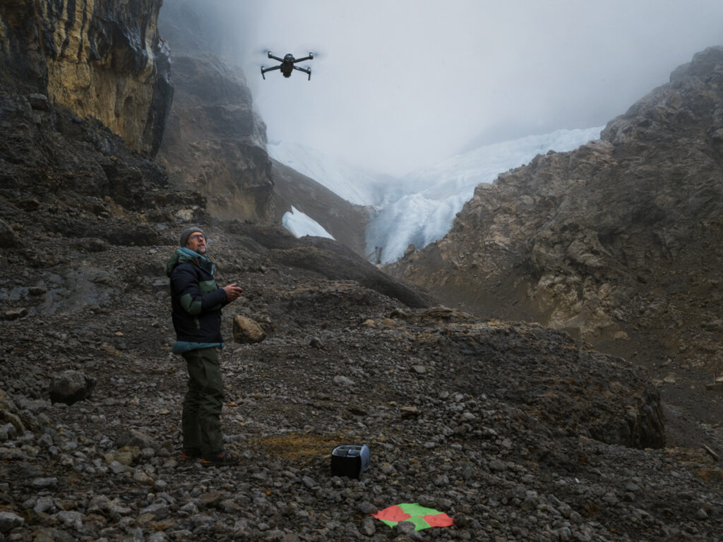
Thymann worked with a local military guard who had accompanied him to place colorful ground control targets around the area. These targets helped Thymann’s drone to calibrate its location as it captured hundreds of high-resolution images. These images were later combined to create the photogrammetry model.
“I was surprised to see there was still some ice left,” Thymann said. “But mountains are like fractals. It’s very difficult to judge scale. And, of course, it’s very very little that’s left.”
Francine Hematang, a forestry and environmental scientist at Papua University in Indonesia, was not involved with Project Pressure’s efforts but recently led a study that used satellite data to document the decline of Puncak Jaya’s glaciers from 1980 to 2024. The study’s results suggested that the glacier area atop the mountain declined by 97% in that 44-year period. Four of the mountain’s six glaciers disappeared completely. Hematang called Project Pressure’s survey “excellent.”
“It uses photogrammetry, which will certainly capture the details of the glacier much better than satellite imagery,” he told Eos in an email. “With photogrammetry, we might be able to see the glacier’s boundaries and slope gradients in detail, and perhaps estimate its volume as well.”
Belau said that the accurate mapping data could allow locals to share the stories of the glaciers with future generations. After all, he said, “eternity glaciers…is just a name now.”
—Emily Gardner (@emfurd.bsky.social), Associate Editor
Citation: Gardner, E. (2026), The “eternity glaciers” are almost gone, Eos, 107, https://doi.org/10.1029/2026EO260228. Published on 16 July 2026.
Text © 2026. AGU. CC BY-NC-ND 3.0
Except where otherwise noted, images are subject to copyright. Any reuse without express permission from the copyright owner is prohibited.