Editors’ Highlights are summaries of recent papers by AGU’s journal editors.
Source: Water Resources Research
Groundwater models are fundamental for tackling a wide range of water resources problems but are inherently challenging to parameterize due to the sparsity of subsurface data. Geophysical data can help address this by providing proxy measures of hydraulic properties, potentially offering a spatially rich dataset. There is growing interest in using airborne geophysical surveys for this purpose as they can provide insight into the spatial heterogeneity of an entire aquifer system.
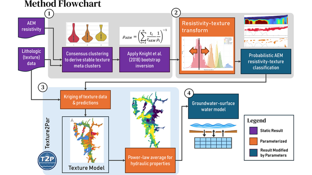
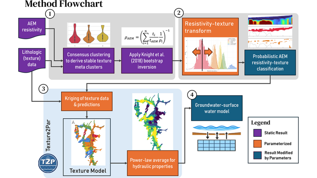
Scantlebury and Harter [2026] offer a novel approach for deriving hydraulic structure models over large spatial scales from the integration of airborne geophysics models of subsurface electrical resistivity and borehole data, recognizing the uncertainty in resistivity-lithology relationships. The derived structures can then be incorporated into a groundwater model, as demonstrated by the authors in an application to the Scott Valley aquifer system. Such a workflow could improve significantly the utilization of large-scale geophysical data for reducing groundwater model predictive uncertainty.
Citation: Scantlebury, L., & Harter, T. (2026). From resistivity to hydraulic properties: Calibrating a groundwater flow model by integrating airborne electromagnetic and borehole data into a probabilistic multi-texture framework. Water Resources Research, 62, e2025WR042695. https://doi.org/10.1029/2025WR042695
—Andrew Binley, Associate Editor, Water Resources Research
Text © 2026. The authors. CC BY-NC-ND 3.0
Except where otherwise noted, images are subject to copyright. Any reuse without express permission from the copyright owner is prohibited.