Some states are lining up for their snowiest winter in years, while others could barely see a flake. Much of that comes down to an El Niño that could reach record strength, and a new USGS outlook ties winters this strong to heavier snow in some states and thinner, earlier melting snow in others.
That El Niño is still strengthening. NOAA’s Climate Prediction Center gives it a 75 percent chance of becoming the strongest in more than 75 years of records this fall, and the newest winter outlook from the National Weather Service shows which states are likely to get more precipitation than normal, with some of that falling as snow wherever it’s cold enough.
States in the Snow Path
California, Nevada, Utah, Colorado, Arizona and New Mexico are all favored for above normal snow in OpenSnow’s winter forecast, from the Sierra around Lake Tahoe to the southern Rockies.
They aren’t the only states in play. The same pattern could bring snow to parts of the South that rarely see it, the timing shifts sharply from one region to the next, and a few northern states that usually count on a long snow season could come up short.
What NOAA’s New Map Shows
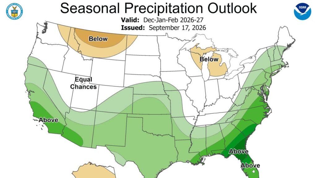
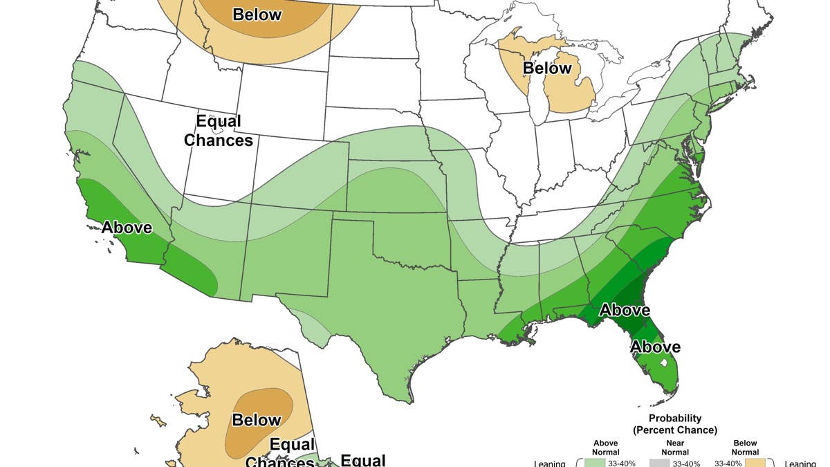
The December through February map shows the odds of above or below normal precipitation, rain and snow combined. It doesn’t forecast snow directly, so the useful question is where those odds overlap with places cold enough for snow.
The clearest overlap is in the Southwest’s high country. Green covers the mountains of Southern California and Arizona and stretches across New Mexico into southern Colorado, terrain high enough that much of the extra precipitation should fall as snow. Along the East Coast, green follows the Appalachians all the way to Maine, which lines up with the late season snow expected in the Northeast. The green over Texas, Oklahoma and Kansas matters only when cold air arrives, but that’s where any southern snowstorm would draw its moisture from.
NOAA / Climate Prediction Center
The darkest green, over Georgia and Florida, will mostly fall as rain. Montana and Michigan lean drier than normal, and the northern Plains and the Great Lakes show no lean either way, so snow there depends more on temperature than on precipitation.
Why the Snow Could Be Historic
This El Niño could become the strongest on record, and winters like this push the storm track south, sending more storms into the Southwest and the southern Rockies. Where those storms meet cold mountain air, they fall as snow.
USGS shows how that plays out. Strong El Niño winters have historically brought increased snowfall to the southern Rockies, including Colorado, and USGS expects more snow to build at higher elevations there this season. Its research on El Niño and snow finds the same pattern in the high Sierra.
The Weather Company goes further, calling those mountains this winter’s jackpot and expecting their best, most consistent snow in years. That would be a sharp turn from last winter, which OpenSnow ranks among the worst snow seasons on record for the West as a whole.
When the Snow Arrives
Fall. The first storms are already landing in the favored zone. Pikes Peak in Colorado picked up its season’s first meaningful snow on September 30, with up to 13 inches overnight and 18 inches over five days, and Arizona Snowbowl outside Flagstaff got 2 inches a night earlier. Both storms hit right where the forecasts point, and the Pikes Peak snow came after Colorado’s fifth-driest January to July since record keeping began in 1895.
January. The South gets its best shot. The Weather Company expects the Deep South to run cooler than average that month, and USGS notes that the Appalachians and parts of the south-central U.S. often turn snowier in El Niño winters.
February. The Northeast catches up. Colder air should reach the region for a snowier finish to winter, and the Farmers’ Almanac expects several rounds of heavy, wet snow inland from January through February.
Where Snow Could Fall Short
The Weather Company expects a thinner snow season from the Midwest into the Northern Rockies, and USGS sees Montana and the Dakotas getting less snow that melts earlier. NOAA’s next El Niño update arrives October 8, with new winter maps on October 15.
What It Means for the Roads
Mountain passes in the West. A big snow year in the Sierra and the Wasatch puts more ski traffic on routes that close in heavy storms, including I-80 over Donner Pass, US-50 to South Lake Tahoe and the canyon roads up to Utah’s resorts. Caltrans posts chain controls in three levels, and at the highest level every vehicle needs chains, including four wheel drive models. Practicing installing them once at home saves time on a cold, narrow shoulder.
Snow and ice in the South. Southern cities keep small fleets of plows and salt trucks, so even a light January snowfall can close interstates for a day or longer. Bridges and overpasses ice over first because they lose heat from above and below. Cold weather also cuts a battery’s cranking power, so an older battery is worth testing before the first freeze.
Late season storms in the Northeast. Winter wiper blades and a washer fluid rated for freezing temperatures keep the windshield clear when wet snow builds up at highway speed, and clearing snow off the roof before driving keeps it from sliding onto the glass or the car behind.
If you drive an EV. Cold weather cuts range, and running the cabin heater adds to the loss. Preconditioning the car while it’s still plugged in and using heated seats and wheel instead of blasting cabin heat both help. Plan charging stops with a larger buffer than you would in summer, especially on mountain routes where a closure or slow traffic can burn through the battery.