Reliable weather data are key to daily human life—planning an outing, planting crops, and preparing for disasters all rely on knowing what weather to expect. Accessing accurate rainfall data is critical.
But sometimes, rain gauges get blocked, filled with dust, or even plugged with spiderwebs, which makes rainfall data unreliable.
“We’ve run into this problem a lot,” said Irené Tematelewo, a data scientist at Microsoft and a former member of the quality control team for the Trans-African Hydro-Meteorological Observatory (TAHMO), a network of low-cost weather stations installed across Africa.
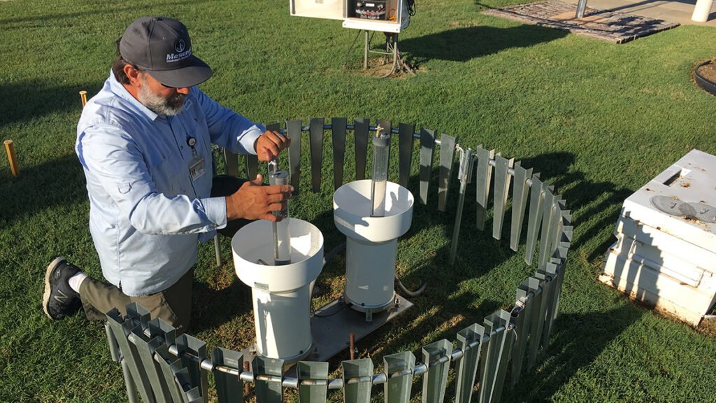
Weather networks can check for faulty rain gauge data in a variety of ways. At the Oklahoma Mesonet, a ground-based weather network designed and run by the University of Oklahoma and Oklahoma State University, blocked gauges are “a very common problem,” said Chris Fiebrich, a meteorologist at the University of Oklahoma.
“This is a great topic to be looking at to improve the quality of precipitation data, especially in a data-sparse area like Africa.”
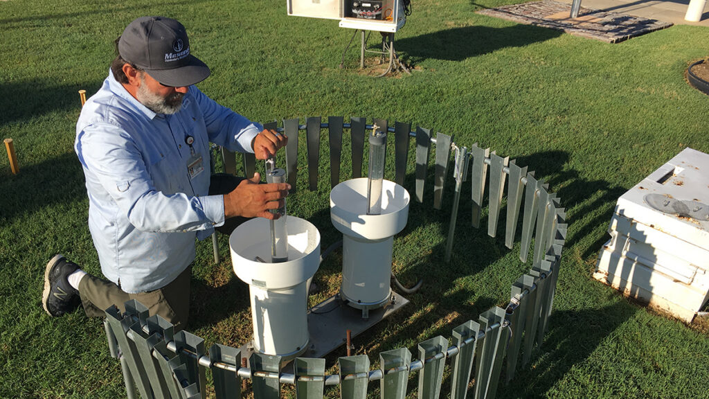
At the Oklahoma Mesonet, scientists conduct quality control by comparing rain gauge data to weather radar. Rain gauges in the network are also installed in pairs, so it’s typically quite clear that there’s a problem when the two rain gauges show vastly different readings.
Weather networks like TAHMO, though, aren’t fully covered by weather radar and don’t have the resources to install pairs of rain gauges in their systems. In these scenarios, scientists must use algorithms to identify clogged rain gauges.
A new study led by Tematelewo and published in Artificial Intelligence for the Earth Systems tested the efficacy of four common ways that data scientists detect faulty rain gauges in their networks. Researchers found that some of these methods require dense station spacing, making them less suitable for monitoring sparse ground-based weather networks.
“This is a great topic to be looking at to improve the quality of precipitation data, especially in a data-sparse area like Africa,” Fiebrich said.
Rain Gauge Revisions
Tematelewo and the research team focused on four commonly used algorithms that all used data from neighboring rain gauges to infer whether rainfall data at a specific rain gauge were faulty.
The first algorithm simply predicts whether a rain gauge should have measured rainfall on the basis of the measurements of its neighbors. The second, the algorithm that TAHMO currently employs, uses the likelihood of rainfall and its expected volume. The third adds historical data on the relationship between rain gauges to the equation, and the fourth includes the distance between rain gauges as another factor.
To test the efficacy of these methods, Tematelewo and the research team implemented each of them on both the TAHMO network and the Oklahoma Mesonet. They created fake faulty data points in both datasets to test how well and how quickly each of the four algorithms could detect the fake faulty rain gauges.
“In TAHMO, the correlation is just much weaker than in Oklahoma, which makes detection much more difficult.”
The researchers found large differences in how correlated each network’s rain gauges were with their neighbors. In the Oklahoma Mesonet, one gauge’s rainfall measurement was highly related to its neighbor gauge’s rainfall measurement, making all the algorithms effective at spotting faulty gauges. But in the TAHMO network, neighboring gauges weren’t nearly as correlated, even in areas with a denser array of stations. None of the algorithms detected faulty rain gauges in the TAHMO network at an acceptable rate.
“In TAHMO, the correlation is just much weaker than in Oklahoma, which makes detection much more difficult. The amount of signal available to diagnose a broken station is not that strong,” Tematelewo said.
Scientists speculate that difference may be at least partly attributable to the variability of terrain and climate across the TAHMO network, which spans the entire continent. In Africa, Tematelewo said, there can be drastic differences in precipitation over the course of just a few kilometers. But in Oklahoma, rainfall patterns are more uniform, and there aren’t huge changes in topography that induce variability in precipitation, Fiebrich said.
Tematelewo wants to further investigate the drivers of the poor performance of algorithms used on the TAHMO network. “We don’t have a definitive answer for why that’s the case,” he said.
Network Upgrade
On the basis of the results, Tematelewo recommends that TAHMO increase the density of its rain gauges or install redundant rain gauges to increase the signals that are available to detect faulty instruments. TAHMO has a goal of eventually deploying 20,000 weather stations; it currently operates around 600.
Data quality control processes for TAHMO and similar networks should also use multiple algorithms to improve detection accuracy, Tematelewo said. “You might want to use more than one to catch the strengths of each of the algorithms and make the diagnosis more robust.”
Overall, more research is needed to learn how data quality control methods that operate effectively in well-developed networks like the Oklahoma Mesonet can work in developing networks like TAHMO.
“It’s great to evaluate this in a place like Africa, because there are a lot of other networks that are in the same situation, or have only one gauge [at a station],” Fiebrich said. “Providing that analysis is really helpful.”
—Grace van Deelen (@gvd.bsky.social), Staff Writer
Citation: van Deelen, G. (2026), Detecting blocked rain gauges for reliable weather data, Eos, 107, https://doi.org/10.1029/2026EO260374. Published on 19 November 2026.
Text © 2026. AGU. CC BY-NC-ND 3.0
Except where otherwise noted, images are subject to copyright. Any reuse without express permission from the copyright owner is prohibited.