
Flood Warnings are active across Mississippi and Alabama today, Thursday, May 7, 2026, after a slow-moving cold front delivered 3 to 5 inches of rain overnight from East Central Louisiana into West-Central Alabama. The Weather Prediction Center flagged the corridor with a Moderate Risk for excessive rainfall through 7 AM CDT, and NWS Jackson and NWS Mobile have followed with active river Flood Warnings on Tallahala Creek and the Chickasawhay.
Peak Driving Danger Window
The most dangerous driving window runs through Thursday afternoon into Friday morning along I-59 between Hattiesburg and Meridian, where saturated soils, rising stages on the Tallahala and Chickasawhay, and lingering training showers will keep standing water active long after the rain ends.
What to Expect
- Rainfall totals: 3 to 5 inches widespread, locally higher across Central and South Mississippi
- Worst corridors: I-20 (Jackson to Birmingham), I-59 (Hattiesburg to Tuscaloosa), I-65 (Birmingham southward)
- Active rivers: Tallahala Creek at Laurel, Chickasawhay at Leakesville
- Friday outlook: Renewed Slight Risk along the Upper Texas Gulf Coast into the Lower Mississippi Valley
Per the NWS Jackson Area Forecast Discussion, the heaviest cores tracked through East Central Louisiana into Central, East Central, and South Mississippi, with a 2 to 3 inch backdrop everywhere else under the front.
Road Conditions
I-59 is the highest-risk corridor through Friday. Tallahala Creek runs almost adjacent to the interstate near Laurel, and the Flood Warning there extends into Friday afternoon. I-20 between Jackson and Meridian crosses multiple swollen tributaries to the Pearl, with shoulder runoff and ramp ponding likely through the morning commute. I-65 in central Alabama gets the tail-end rain through midday. All-weather tires with at least 4/32-inch tread hold meaningful margin in standing water; summer tires lose grip fast. Live status is on MDOT Traffic.
Severe Storm Driving Tips
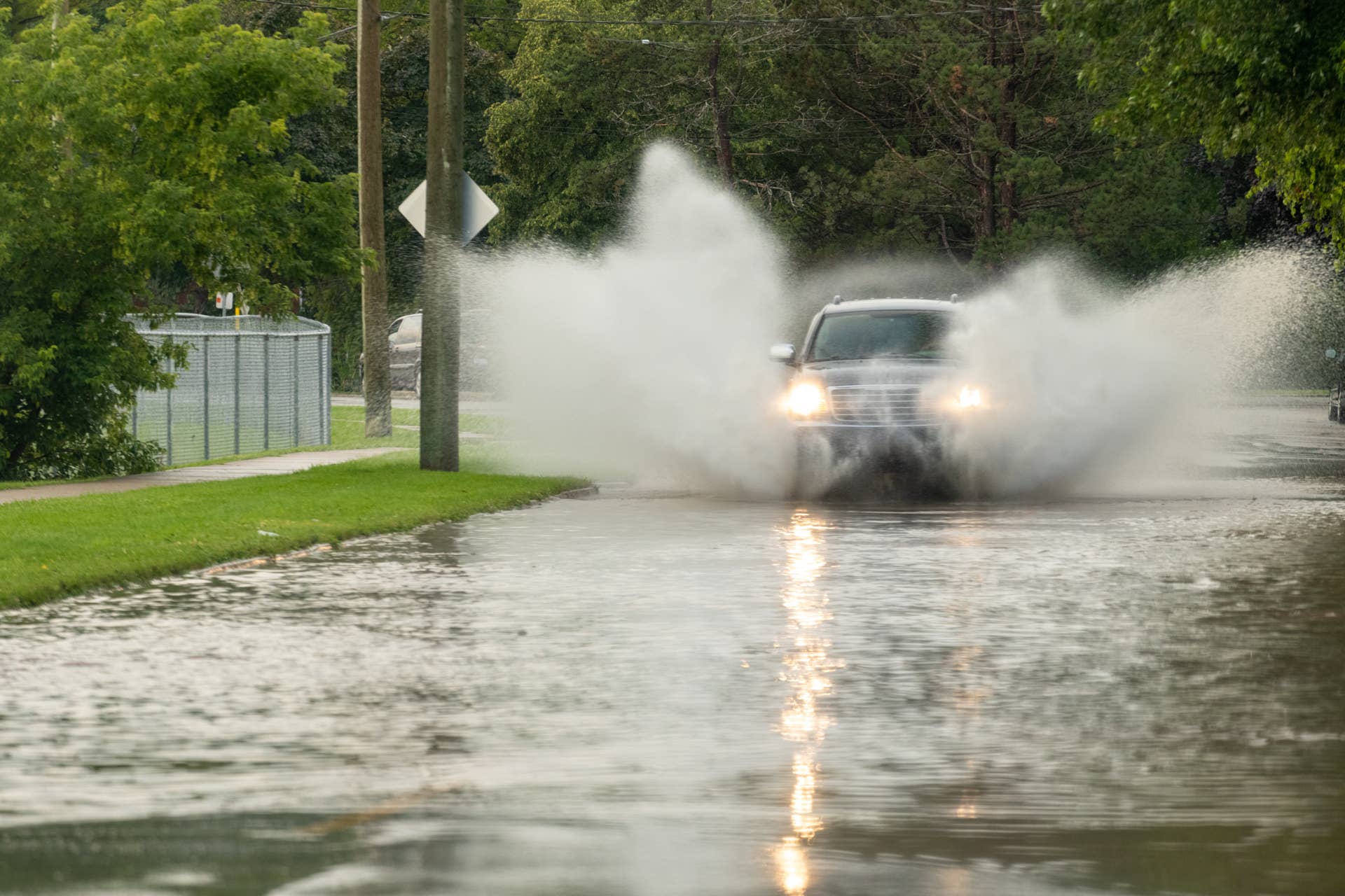
Six inches of moving water can stall most cars, twelve can float a small sedan, and eighteen will carry an SUV. NWS guidance notes that more than half of flood deaths happen in vehicles, most at night when standing water hides depth. Cut speed to 45 mph or below in any sustained downpour, since hydroplaning kicks in once standing water exceeds an eighth of an inch. Confirm at least 4/32-inch tread depth before entering the warning area, and treat any flooded underpass as closed regardless of how shallow it looks. Practical wet-weather driving technique and live Alabama corridor cameras at ALGOtraffic round out the prep.
Timing
The Tallahala Flood Warning runs through Friday afternoon, and the Chickasawhay warning extends into the weekend. WPC has a renewed Slight Risk for excessive rainfall Friday from the Upper Texas Gulf Coast through the Lower Mississippi Valley, with backbuilding storms threatening Houston, San Antonio, and New Orleans. We’ll update this article as conditions evolve.