Most of the winter forecasts out so far have dealt with where the heavy snow goes. A strengthening El Niño has pulled the storm track south, and the states facing heavy snow this winter are mostly in the West and the southern Rockies.
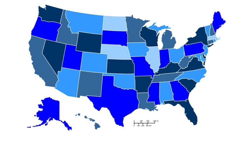
The Old Farmer’s Almanac fills in the other side of the forecast. Its winter 2026-27 outlook puts eight of its eighteen regions below normal or near to below normal for snowfall, and you can view the map here.
For drivers in those regions, that sounds like a season off. The rest of the forecast complicates it: half of the eight are also called wetter than usual, and the same El Niño is steering storms in warm enough that they fall as rain, sleet or freezing rain.
States In The Low-Snow Regions
|
Region |
States |
Snowfall |
Precipitation |
Temperature |
|
Atlantic Corridor |
MA, RI, NJ, NY, PA, MD, DC, VA |
Slightly below normal |
Below normal |
Above normal |
|
Lower Lakes |
MI and parts of WI, IL, IN, OH, PA, NY |
Near to below normal |
Above normal |
Above normal |
|
Ohio Valley |
KY and parts of IL, OH, PA, WV |
Slightly below normal |
Above normal east, below west |
Below normal |
|
Deep South |
LA, MS, AL and parts of AR, FL, TN |
Below normal |
Below normal north, above south |
Above normal |
|
Upper Midwest |
Parts of MN, ND, SD, WI |
Near to below normal |
Above normal east, below west |
Above normal |
|
Heartland |
IA and parts of KS, MO, NE, SD, MN, IL, WI |
Near to below normal |
Above normal |
Above normal |
|
High Plains |
Parts of MT, CO, ND, SD, NE, NM, TX, OK, KS |
Below normal |
Below normal |
Above normal |
|
Desert Southwest |
Parts of CA, AZ, NM |
Below normal where snow normally falls |
Below normal |
Above normal |
Northern New England belongs on the list as well, inside a Northeast region the Almanac splits between above-normal snow in the south and below normal in the north. Texas and Oklahoma do not, despite being grouped in by some coverage. That region is warmer and drier with snowfall near normal.
Editor-in-chief Carol Connare framed the outlook around regional variation rather than mildness, saying “Winter won’t look the same everywhere this year.” The other side of the same map runs through the southern Northeast, the Appalachians, the Intermountain West, the Pacific Northwest and Alaska, all called snowier than normal, which overlaps closely with the states favored for above-normal snow in other winter outlooks.
The states that run seasonal traction laws and chain requirements are concentrated in the West, largely outside these eight regions.
Rain Is The Bigger Crash Category
Federal Highway Administration data, averaged over 2019 to 2023, records 574,047 weather-related crashes a year on rain or mist against 219,942 during freezing precipitation of every type combined.
Part of that is behavior. Wet pavement pulls arterial speeds down by 10 to 25 percent and snow or slush by 30 to 40 percent, because drivers react to a surface they can read. A refrozen film on a road that spent the afternoon wet gets no such reaction, and it forms first on bridge decks and overpasses. Crews are working against the clock rather than the volume, since anti-icing brine has to be down before freezing rain starts.
The Wet Half Of The List: El Niño Decides Precipitation Type
The Lower Lakes and the Heartland are forecast above normal on precipitation and near to below normal on snow, and the Upper Midwest carries the same combination across its eastern half. That covers Michigan through Iowa.
Whether a given storm comes down as snow or rain depends on a temperature profile a few hundred feet thick, and no seasonal forecast can call that months out. The competing Farmers’ Almanac, a separate publication with its own method, describes an active track from Southern California and the Desert Southwest through Texas, the Gulf Coast and the Southeast, with temperatures near freezing often enough that the rain, sleet or snow question stays open until each system shows up.
NOAA’s Climate Prediction Center puts the odds of a very strong El Niño above 90 percent for fall and winter, and both forecasts lean on it.
Driver Assistance Systems And Rain
The safety equipment fitted to almost every new car sold into these regions is the equipment that degrades in the conditions the forecast favors. AAA ran closed-course testing in simulated moderate to heavy rain and found vehicles with automatic emergency braking hit a stopped car in 33 percent of runs at 35 mph. Lane keeping assistance left the lane in 69 percent of runs. Radar holds up better than camera-based sensing in precipitation, which is why results vary by system rather than by badge.
Tires carry more of the load in a wet winter than a snowy one. Water has to be cleared from the contact patch, and the tread doing that work gets shallower with every mile. Most states set the legal minimum at 2/32 of an inch, and wet braking distance falls away well before a tire reaches it.
All-season compounds also stiffen as air temperature drops toward 45 degrees Fahrenheit, which is above freezing and well inside what a mild winter delivers. A below-normal snow forecast is the reason plenty of drivers in these eight regions will skip switching to winter tires this year.
The Ohio Valley Is The Cold One
Seven of the eight regions are forecast warmer than normal. The Ohio Valley is not, and it is the only place on the list where below-normal temperatures sit alongside above-normal precipitation in the east.
Cold air, extra moisture and a snow total that still finishes under normal describe sleet and freezing rain rather than a quiet season. Kentucky and the surrounding parts of Illinois, Ohio, Pennsylvania and West Virginia are where the two halves of this forecast meet.
What Is Not Settled: Two El Niño Updates Land This Month
The two forecasts do not agree on the Atlantic Corridor. The Almanac has it mild and dry from Massachusetts through Virginia, while the Climate Prediction Center’s seasonal outlook maps favor above-normal precipitation along almost the entire East Coast. Those are opposite calls on the same stretch of I-95.
The Almanac claims an average accuracy of 80 percent using a method it does not publish, and it graded its own previous winter as broadly correct while conceding it underestimated snowfall from Boston through New York and across the Lower Lakes. A regional call assigns a tilt to a three-month average and cannot place individual storms, which is why a below-normal season still contains the ice event that closes an interstate. CPC issues its next ENSO Diagnostic Discussion on September 10 and replaces its seasonal outlook maps on September 17.