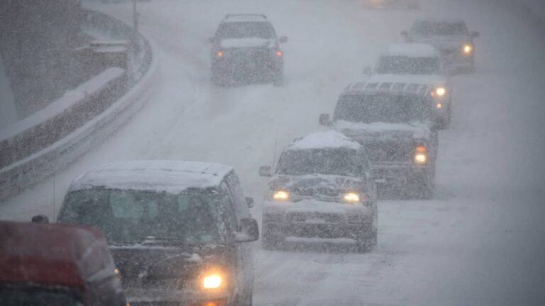
If you were planning to drive the Beartooth Highway before it shuts for the winter, this weekend’s forecast is already getting in the way. The snowfall forecast covers the high ground of western Wyoming and northern Alaska, and the totals are smaller and far more concentrated than a colored map suggests. NWS Riverton has up to 4 inches on Cloud Peak in the Bighorns and nothing at all on almost every highway pass in Wyoming. NWS Fairbanks has 1 to 3 inches on Atigun Pass, the only place in this forecast where accumulating snow is expected on a road used by trucks.
What Riverton’s Snow Map Actually Says
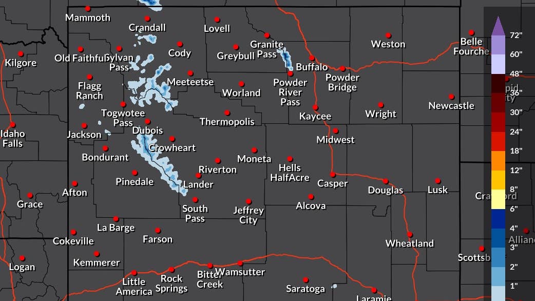
Riverton runs an experimental probabilistic snowfall product that breaks the forecast down location by location, and the run issued at 7:16 a.m. ET Friday is valid from 8 a.m. ET Friday through 8 a.m. ET Monday.
NOAA / National Weather Service
Cloud Peak in the Bighorns carries the largest number in the state: 3 inches expected and 4 at the high end, with a 95 percent chance of measurable snow and a 54 percent chance of clearing 2 inches. Francs Peak in the Shoshone National Forest comes in at 2 inches expected. Gannett Peak in the Wind Rivers shows 1 inch and the strongest probability on the board at 98 percent.
The accumulation stops there. Togwotee Pass on US 26/287, South Pass and both Yellowstone entrances all read zero, along with every town in the forecast area.
Beartooth Pass Is The One Wyoming Road With A Real Chance Of Snow
Beartooth Pass is the exception to the zeros, with half an inch expected and a 59 percent chance of measurable snow. That would be a rounding error anywhere else in September. US 212 crosses the pass at 10,947 feet, and WYDOT already shut the segment from the Long Lake barricade to the Montana state line at 5 p.m. on September 10, on a forecast of three inches and gusts to 55 mph.
The one way through to Cooke City is WY 296 over the Chief Joseph Scenic Byway, which Riverton has at zero this weekend.
Alaska Puts 1 To 3 Inches On Atigun Pass
The NWS Fairbanks forecast discussion issued at 6:24 p.m. ET Thursday has “accumulations of 1-3 for parts of the Brooks Range, including Atigun pass Friday evening through early Saturday morning.” Atigun sits at Mile Post 244 of the Dalton Highway and crosses the Continental Divide at 4,739 feet, the highest year-round maintained pass in the state, and September traffic over it is trucks running to Deadhorse rather than tourists.
Further west, forecasters have snow showers in the Bering Strait and the higher ground of the Seward Peninsula from Friday night through Saturday. “Snow could be heavy at times, and minor snow accumulations will be possible even at sea level,” the discussion reads. “The locations that will see the highest amounts will be those above 1000ft in the Seward Peninsula.”
That line matters for the three gravel highways out of Nome. Kougarok Road runs 86 miles north through the Kigluaik Mountains, which includes terrain above 1,000 feet, and Alaska DOT&PF does not maintain it beyond Milepost 13 in winter. The department’s guidance on those roads is blunt: “Travel is strongly discouraged for your safety.”
Before You Drive
Studded tires became legal again on Wednesday north of the 60th parallel. Alaska’s rules bar them on paved roads from May 1 through September 15, which leaves the gravel highways out of Nome outside that restriction. Chains carry no date restriction at all.
In Wyoming, overnight refreezing could be a bigger problem than the snowfall itself. Half an inch falling on pavement that is still warm can melt on contact, then refreeze after dark into a film that looks identical to wet asphalt. All-wheel drive does not solve that. It can help a vehicle accelerate on slippery pavement, but it does not shorten braking distances. Tread depth and proper inflation still matter. Pressure falls with the temperature at about a psi per 10 degrees, which is enough to leave a set last checked in midsummer measurably low before it reaches the pass.
What A Very Strong El Niño Means For These Passes
The Climate Prediction Center’s September 10 update puts the odds of a very strong El Niño this fall and winter above 90 percent, with a 75 percent chance that the October through December season exceeds every event back to 1950. Forecasters are careful to say that raises the odds of El Niño impacts without guaranteeing them.
For drivers that is a signal about the winter ahead, not about this weekend. A pass that closes on half an inch in September closes on the same margins in January, whatever the seasonal outlook says.