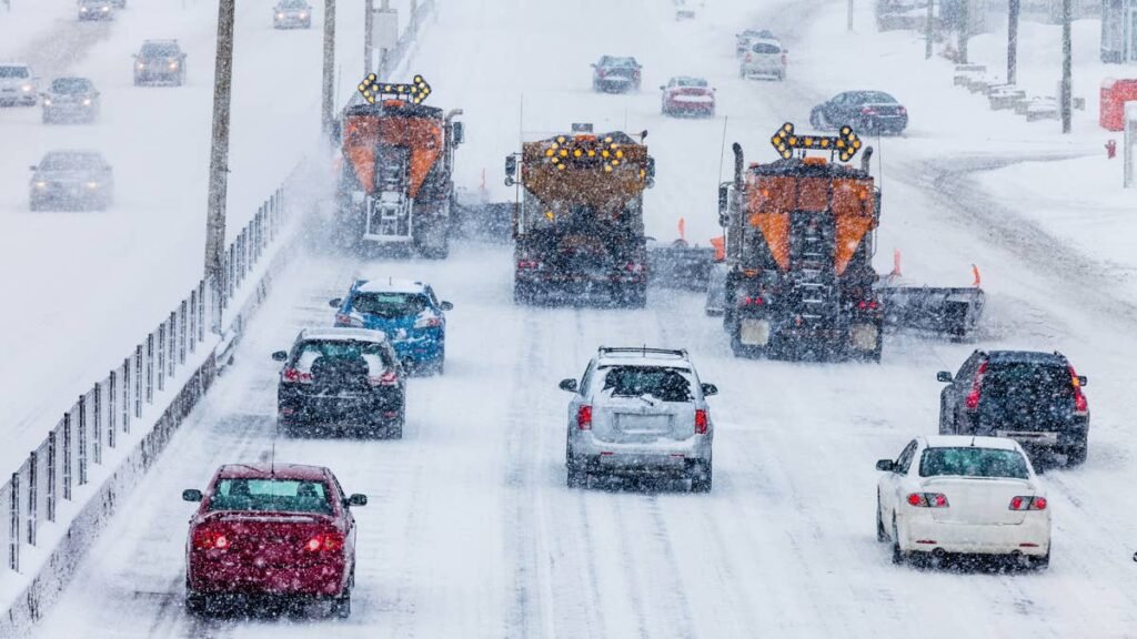
The first week of November looks stormier than the rest of the month, and forecasters at the National Weather Service see a chance of heavy snow in the western mountains as it begins. The Climate Prediction Center’s week two hazards map, which looks out to November 7, marks a slight risk of heavy snow over two mountain corridors, while its outlook for the full month favors warmth across the northern two thirds of the country. For drivers, the main concern is early season snow on western mountain passes, not widespread winter weather.
Where The Heavy Snow Risk Sits
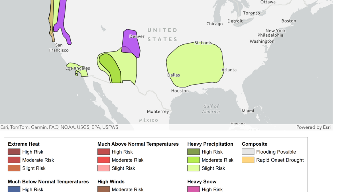
The Days 8 to 14 Hazards Outlook, made October 24 and covering November 1 to 7, outlines two areas with a slight risk of heavy snow. The longer one follows the Cascades from the Canadian border through Washington and Oregon and continues south into California’s Sierra Nevada. The second covers the Colorado Rockies, reaching east to the Front Range around Denver. Compared with the version made two days earlier, the risk in the Rockies has shifted south out of western Wyoming and now centers on Colorado. That fits the pattern private forecasters expect from El Niño this season, with AccuWeather senior meteorologist Chad Merrill noting in the company’s winter forecast that “the primary storm track, particularly in the first part of winter, will be across the southern U.S.”
NOAA / Climate Prediction Center
Farther south, the map shows a moderate risk of heavy precipitation in Arizona and western New Mexico, with lighter risks across the rest of the Southwest, near the Southern California coast and from Texas into the Lower Mississippi Valley. Most of that falls as rain at lower elevations.
The Rest Of The Month Leans Warm
The November outlook, issued October 15 by forecaster Johnna Infanti, expects El Niño to be “the dominant climate driver” through the month. It favors above normal temperatures across the northern two thirds of the Lower 48, with the highest odds in Washington, the interior Northwest, the Northern Plains, the Upper Mississippi Valley and the Great Lakes, and it leans dry from the northern Intermountain West into the Northern Plains and across parts of the Great Lakes. The outlook favors wetter conditions across the southern U.S. and along the East Coast, mostly in the form of rain.
Infanti also calls November “a transition month for ENSO impacts for some regions,” and Montana and North Dakota carry a weaker warm tilt because “diving troughs may introduce cooler spells.” The Climate Prediction Center updates the November outlook on October 31.
Traction Laws On The Main Mountain Routes
Both risk areas sit over some of the busiest mountain crossings in the West, including Interstate 90 over Snoqualmie Pass in Washington, Interstate 80 over Donner Summit and U.S. 50 over Echo Summit in the Sierra, and the Interstate 70 corridor through the Colorado Rockies. In Colorado and California, all wheel drive alone does not guarantee an exemption from winter traction requirements.
Colorado’s Traction Law is in effect every year from September 1 through May 31 on the I-70 Mountain Corridor between Dotsero and Morrison, and the Colorado Department of Transportation activates it during winter storms. Under the requirements CDOT updated last November, the law “applies to all 4WD and AWD vehicles,” which need at least 3/16 of an inch of tread on winter tires with the mountain snowflake symbol, all weather rated tires or mud and snow (M+S) tires. A vehicle that falls short needs chains or an approved alternative traction device on two or more drive tires, and noncompliance carries a $50 fine plus a $17 surcharge.
California’s chain controls work in three levels. At R1, chains are required on everything except passenger vehicles with snow tires on the drive wheels. At R2, the level Sierra drivers meet most often, only four wheel and all wheel drive vehicles with snow tread tires on all four wheels are exempt, and Caltrans still requires them to carry traction devices. At R3, every vehicle needs chains, with no exceptions.