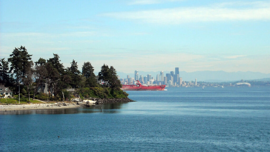
The winter earthquake of 923 or early 924 CE remains the benchmark event in the Seattle Fault Zone. It lifted shorelines around Puget Sound and gave geologists one of the most decisive records of the fault’s power.
But that shoreline-lifting earthquake is only part of the zone’s history. A recent Geological Society of America Bulletin study led by Stephen J. Angster, a geologist with the U.S. Geological Survey, looks past the most famous Seattle fault earthquake to examine evidence of earthquakes on lesser-known secondary faults.
At Lytle Beach on Bainbridge Island and at Vasa Park near Bellevue, subtle landforms and trench records suggest evidence of smaller ruptures has been preserved in the landscape but not fully recognized.
At Lytle Beach, the first clue was a small, raised surface. Angster described the “localized uplifted terrace” as “the first feature we saw that drew our eye to that area.” Similar features had already helped geologists read other secondary faults in the Seattle Fault Zone.
For instance, Angster said the Toe Jam Hill fault became one of the better-known examples when lidar helped reveal its scarp through dense vegetation. Later work found smaller uplifted terraces near similar secondary structures, which Angster said may indicate separate earthquake events focused on smaller faults rather than the larger regional rupture.
However, Lytle Beach stood out in a different way, as its fault dips south, in contrast to the zone’s better-known secondary faults, which dip north.
Faults Hidden in the Fold
Finding the localized uplifted terrace was only the beginning for Angster, who used lidar to uncover scarps and lineaments through the region’s forest cover.
His team also utilized ground-based magnetic transects across the Lytle Beach fault to look for changes that may reveal displacement beneath the surface. In addition, they gained a more direct view of disturbed sediments by excavating the Rose Hip trench across the newly identified Lytle Beach scarp and analyzing evidence from the earlier Vasa Park trench.
In the Rose Hip trench at Lytle Beach, Angster said the team found glacial deposits dating to roughly 15,000 years ago. Above them were lake sediments left behind as ice retreated. The trench also preserved an old layer of soil that formed after the lake dried. “That whole package was folded,” he said. “The only way you could fold those is mostly by a tectonic fault.”
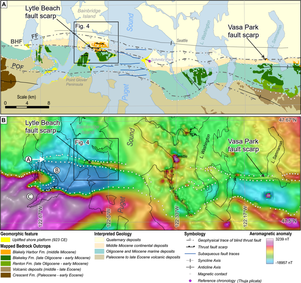
The trench record showed evidence of two surface-rupturing earthquakes on the Lytle Beach fault. The older event occurred between 11,240 and 10,430 calibrated years before present, whereas the younger event occurred after 1663 CE, likely in the early nineteenth century. (“Calibrated years before present” refers to dates arrived at via radiocarbon dating, relative to the year 1950 as the “present.”)
“I thought the trenching on Lytle Beach was surprising, that we found two events, because it was such a relatively subtle feature that wasn’t really identified before,” Angster said.
At Vasa Park, the team found evidence of one past earthquake that occurred sometime between 11,380 and 7,400 calibrated years before present. That range overlaps with the older Lytle Beach event and raises the possibility of a longer rupture along the Blakely Harbor fault. However, the evidence in Angster’s study better supports separate ruptures on the two secondary faults.
A Longer Record of Smaller Ruptures
Harold Tobin, an earthquake scientist at the University of Washington who was not involved in the study, called the work “exciting new research.”
He said the study shows there is “room to accommodate smaller earthquakes” that do not reshape shorelines like the 923 or 924 event but are “still big enough to be damaging earthquakes.” The Angster paper, he said, examines “additional earthquakes not accounted for in the shoreline uplift record centered on the 923 or 924 event. These smaller earthquakes may have happened more recently or more often.”
“Subtle features, relatively small or fault traces that we might have ignored before, can be an important part of the story.”
For Tobin, the value also extends beyond Puget Sound. The study “shines a light for other people working in cities and urbanized settings,” he said, because it shows that “subtle features, relatively small or fault traces that we might have ignored before, can be an important part of the story.”
By comparing the dated events at Lytle Beach, Vasa Park, and other secondary faults, the authors estimated that these faults may have ruptured roughly every few hundred years during the late Holocene. Angster cautioned that it’s not quite clockwork. “The secondary faults appear, especially within the last 2,500 years, to rupture more frequently, and that’s where that 350-year interval comes from,” he said. But the estimate rests on a limited record.
Though the work doesn’t forecast the next earthquake, it gives scientists more of the past to weigh as they assess the Puget Lowland. Tobin said the paper “certainly beg[s] more research” because the Seattle Fault Zone contains many strands that still need to be studied. Earthquake hazards should remain “something real” for the public and civil planners.
“We don’t know when they are going to come,” Tobin said. “Obviously, we can go decades without any significant earthquakes, as we have since 2001. But when we least expect it, one will happen, and we just have to be prepared.”
Angster framed the findings more conservatively: “This study doesn’t really change the hazard with the Seattle Fault. It just provides more insight into how it behaves.”
—Jason Collins, Science Writer
Citation: Collins, J. (2026), Small faults add to Seattle’s quake story, Eos, 107, https://doi.org/10.1029/2026EO260238. Published on 23 July 2026.
Text © 2026. The authors. CC BY-NC-ND 3.0
Except where otherwise noted, images are subject to copyright. Any reuse without express permission from the copyright owner is prohibited.