The National Weather Service has Winter Storm Warnings active for the South Washington Cascades and the Northern and Central Cascades of Oregon, plus the East Slopes of the Oregon Cascades. What is heading for the mountains starting this afternoon is not a routine April shower. A deep Pacific trough is pushing cold air and heavy moisture into the range, and the snow level is dropping fast. Totals above 2,500 feet could reach 21 inches from Marion County to Lane County in Oregon, with 6 to 12 inches on the east slopes above 4,000 feet. Wind gusts are forecast at 45 mph across exposed terrain. The NWS says to “consider delaying all travel.”
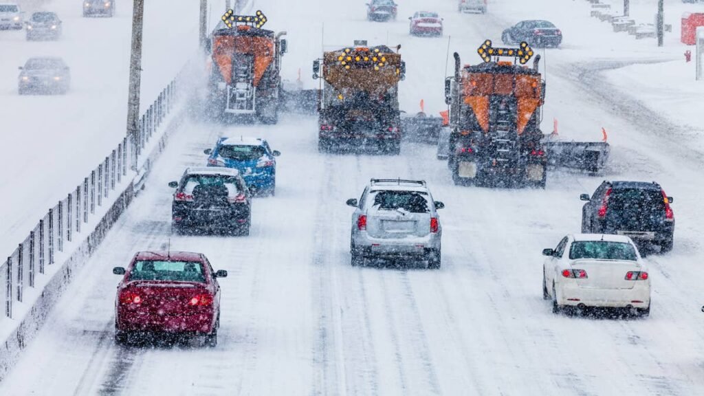
I-90 over Snoqualmie Pass, Highway 2 over Stevens Pass, Highway 58 over Willamette Pass and US-26 over Mount Hood are all in the direct path. Chain controls are virtually guaranteed. Full closures are on the table. Snoqualmie Pass shut down as recently as mid-March during a similar late-season event and stranded drivers for hours. If you do not need to be on the other side of the mountains before Thursday morning, do not go.
Gemini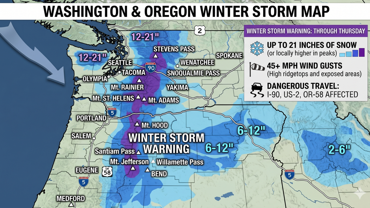
The Storm
A deep upper-level trough is digging into the Pacific Northwest from the Gulf of Alaska. It will push onshore Tuesday afternoon and slowly grind through the region over the next 36 hours before conditions improve Thursday morning. The combination of strong dynamics and a deep moisture plume will deliver sustained heavy snowfall across the full length of the Cascade Range from southern Washington to south-central Oregon.
The critical detail for drivers is the snow level. It starts around 3,000 to 3,500 feet Tuesday afternoon, which means the highest passes get snow right away while lower elevations initially see rain. By Tuesday night the snow level drops to 2,500 feet, and it could dip as low as 1,000 feet in some areas. That means nearly every pass in the Cascades will be dealing with heavy accumulation by Wednesday morning. The heaviest period is forecast from late Tuesday night through Wednesday morning. Snow will taper to showers Wednesday afternoon and evening before the system clears Thursday.
In Washington, a Winter Weather Advisory is active for the central Cascades, including Snoqualmie Pass and Stevens Pass, from late Tuesday morning through Wednesday night. Periods of snow are expected with the heaviest accumulation Tuesday night. South-Central Oregon’s higher terrain above 4,000 feet is also under a separate Winter Storm Warning, with 4 to 12 inches forecast for zones including Willamette Pass and Diamond Lake.
Zone Forecasts
South Washington Cascades and Northern/Central Oregon Cascades (NWS Portland, Winter Storm Warning): Heavy snow above 2,500 feet. Total accumulations of 12 to 21 inches. Winds gusting to 45 mph. In effect from 5 PM Tuesday to 5 AM PDT Thursday. Heaviest snow forecast over the Cascades from Marion to Lane counties.
East Slopes of the Oregon Cascades (NWS Pendleton, Winter Storm Warning): 6 to 12 inches above 4,000 feet, heaviest along the Cascade crest. Lighter amounts below 4,000 feet along US-97, US-26 and US-20. Winds gusting to 45 mph. Significant snowfall rates combined with low visibility will create very difficult driving conditions. In effect from 5 PM Tuesday to 5 AM PDT Thursday.
High South-Central Oregon Cascades (NWS Medford, Winter Storm Warning): 4 to 12 inches above 4,000 feet in Klamath, Jackson and Douglas counties, including Diamond Lake and Willamette Pass. Winds gusting to 45 mph over high and exposed terrain. In effect from 11 PM Tuesday to 5 AM PDT Thursday.
Central Washington Cascades, including Snoqualmie and Stevens Passes (NWS Seattle, Winter Weather Advisory): Snow, heaviest Tuesday night. Accumulations of several inches at pass level. Temperatures in the low-to-mid 30s. Advisory in effect from Tuesday morning through Wednesday night. Conditions could deteriorate enough to close passes if spinouts and collisions pile up, as happened in March.
Getty Images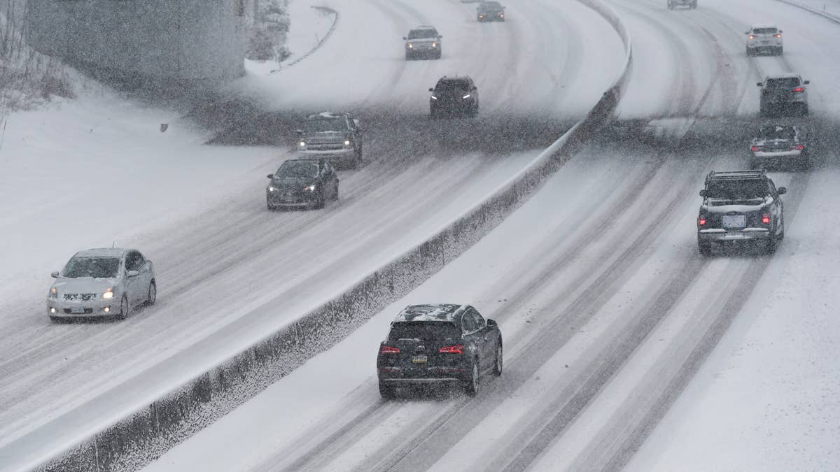
The Highways
I-90 over Snoqualmie Pass (3,015 feet). The primary east-west corridor linking Seattle and Spokane. Current Weather Underground forecasts call for periods of snow through Wednesday, with temperatures in the mid-30s and accumulations building through Tuesday night. Snoqualmie closed in mid-March during a similar late-season storm after multiple spinouts and collisions in both directions. Expect chain requirements at minimum starting Tuesday evening. WSDOT plows 24/7, but during heavy snowfall, fresh accumulation covers lanes faster than crews can clear them.
Highway 2 over Stevens Pass (4,061 feet). Higher elevation means heavier snow totals. Snow-Forecast.com is calling for a heavy fall of snow, heaviest Tuesday night, with temperatures well below freezing. Stevens Pass sits squarely in the warning zone and is exposed to the full brunt of southwest flow. If I-90 closes, Highway 2 becomes the fallback route between western and eastern Washington, and it can quickly become overwhelmed with diverted traffic.
US-26 over Mount Hood / Government Camp (roughly 3,800 to 4,000 feet). Right at the snow level transition zone. Even if accumulations are lighter here than farther south, wet heavy snow and gusty winds can create treacherous conditions on the steep grades between Sandy and Government Camp. ODOT will implement chain requirements as needed.
Highway 58 over Willamette Pass (5,090 feet). One of the highest Cascade crossings in Oregon and squarely in the heavy snow zone. NWS Medford is forecasting 4 to 12 inches above 4,000 feet in this area, with snow possibly heavy at times overnight Tuesday into Wednesday. This highway connects Eugene with the US-97 corridor and central Oregon. It has fewer plowing resources than I-5 alternatives and is typically among the first Oregon routes to close and last to reopen.
Highway 22 over Santiam Pass (4,817 feet). In the heart of the Marion County zone where the NWS expects the heaviest accumulations. Up to 21 inches of snow is possible at this elevation. This route connects Salem to central Oregon and should be treated as extremely high risk from Tuesday evening through Wednesday.
Highway 20 over Tombstone Pass (4,660 feet). Similar exposure to Santiam Pass. Heavy snow, gusty winds and limited visibility will make this route dangerous. Central Oregon commuters should plan for delays or closures.
US-97 along the east slopes. The NWS notes lighter snowfall below 4,000 feet along the US-97 corridor, but drivers should still expect slick and hazardous conditions. Anyone heading east-west over the Cascades and encountering closures will not find a clean alternative.
When To Drive
Tuesday morning and early afternoon (today). Your last window before conditions deteriorate. Snow levels are still above most pass elevations. If you need to be on the other side, go now.
Tuesday evening. Storm arrives in force. Snow levels drop to 2,500 feet. Chain controls begin across multiple passes. Conditions worsen quickly.
Tuesday night through Wednesday morning. The worst window. The heaviest snow rates hit. Visibility drops toward zero in the mountains. This is when closures are most likely at Snoqualmie, Stevens, Santiam, Willamette and every other exposed pass.
Wednesday afternoon. Snow becomes more showery but does not stop. Do not assume roads are open or clear. Plows will be working to catch up after 12-plus hours of sustained heavy snow.
Wednesday night into Thursday morning. Storm exits. But clearing a foot or more of snow off a mountain highway takes hours even after it stops falling. Expect lingering chain requirements and single-lane operations into Thursday.
Thursday afternoon onward. NWS forecasts clearer and cooler conditions. Roads should begin returning to normal, though frost and icy patches in shaded areas will persist, especially on secondary routes.
Why This Storm Is Different
The Cascades get spring snow. That is not news. What makes this one worth paying attention to is the snow level. Dropping to 2,500 feet in mid-April is unusual and puts every major pass in the range into the heavy accumulation zone. Many of these passes sit between 3,000 and 5,000 feet, which means they are not catching the tail end of a high-elevation event. They are right in the middle of it.
What To Carry
Oregon and Washington require chains or traction tires on mountain passes during winter conditions. AWD and 4WD may still need chains depending on conditions. ODOT and WSDOT can restrict travel to chains-required at any time during this storm. Bring tire chains and practice putting them on before you need to, a blanket or sleeping bag, flashlight, portable phone charger, water, food, a folding shovel, cat litter or sand for traction, and a full tank of fuel before entering the mountains.
All-wheel drive helps you accelerate on snow, but it does nothing to reduce stopping distance on ice. If this storm is a reminder that your vehicle is not set up for winter conditions, Autoblog’s winter car readiness checklist covers everything from tread depth to emergency kit essentials, and our guide to best practices for driving in snow and ice covers skid recovery, cruise control hazards and what to keep in your trunk. If you are considering a more capable vehicle for conditions like these, our breakdown of the best cars and SUVs for snow and winter driving is worth a read.
If you get stranded, stay with your vehicle. Run the engine for heat in 15-minute intervals, crack a window for ventilation and wait for road crews.
Road Conditions
Check TripCheck.com for current Oregon highway conditions, live traffic cameras and chain requirements. Check WSDOT Mountain Passes for Washington pass conditions, traction requirements and closures. NWS Portland, NWS Pendleton and NWS Seattle forecast pages are linked in the zone forecasts above.