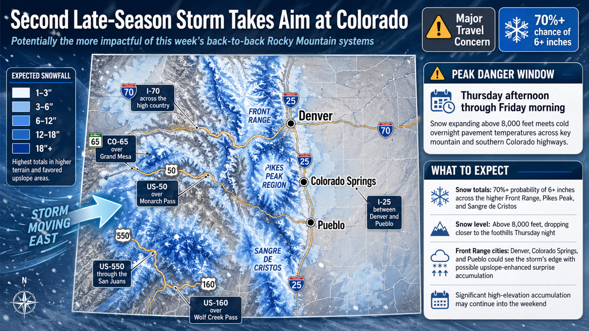
A second late-season storm is taking aim at Colorado and forecasters are flagging it as potentially the more impactful of the back-to-back systems hitting the Rockies this week. The Weather Prediction Center is already calling for high probabilities of significant snow across the Front Range, Pikes Peak, and Sangre de Cristos from Wednesday night into Friday, putting major mountain corridors back in the danger zone just as drivers were getting a brief reprieve from this week’s first storm.
Chat GPT generated image
Peak Danger Window:
Thursday afternoon through Friday morning, when expanding snow above 8,000 feet collides with cold overnight pavement temperatures across I-70, US-50, and southern Colorado highways.
What to Expect
- Snow totals: 70%+ probability of 6 or more inches across the higher Front Range, Pikes Peak, and Sangre de Cristos; significant high-elevation accumulation continuing into the weekend
- Snow level: Above 8,000 feet, dropping close to the foothills as cold air filters in Thursday night
- Front Range cities: Denver, Colorado Springs, and Pueblo will see the storm’s edge with possible upslope-enhanced surprise accumulation
- Worst corridors: I-70 across the high country, US-50 over Monarch Pass, US-160 over Wolf Creek Pass, US-550 through the San Juans, CO-65 over Grand Mesa, and I-25 between Denver and Pueblo
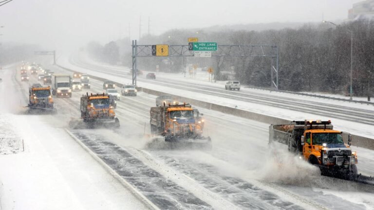
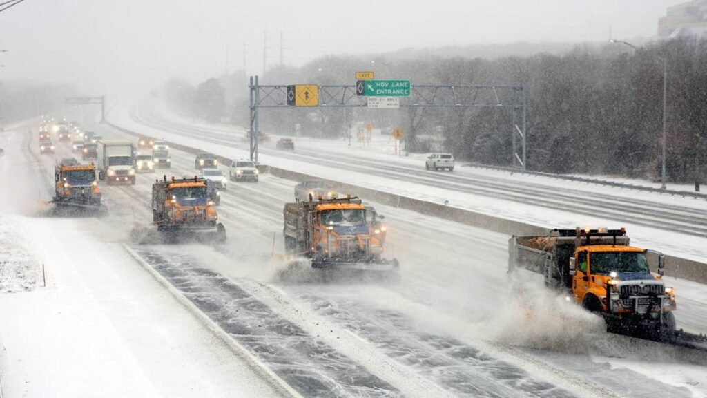
The system begins as a closed mid-level low near Baja Wednesday evening before opening and ejecting east into the Desert Southwest by Thursday. Strong warm and moist advection ahead of the wave will push ascent over the Colorado Rockies again, while easterly low-level flow drives upslope-enhanced moisture into the state from the Southern Plains. This arrives just behind the storm that hit the Rockies Sunday and Monday, which dropped 12 inches across Crested Butte, Monarch Pass, and the San Juans before exiting Tuesday morning.
Road Conditions
The I-70 mountain corridor is once again the headline travel concern. Berthoud Pass on US-40 (11,307 feet), the Eisenhower Tunnel approach (11,158 feet), and Vail Pass (10,662 feet) all sit well above the 8,000-foot snow level forecast for Thursday and Friday. Drivers should expect renewed chain requirements for commercial vehicles and traction law enforcement for passenger cars.
US-50 over Monarch Pass (11,312 feet) and US-160 over Wolf Creek Pass (10,857 feet) are squarely in the southern Colorado heavy snow zone. CDOT has historically closed both passes for snow removal operations during events of this magnitude. The US-550 corridor through Molas Pass, Coal Bank Pass, and Red Mountain Pass remains one of the most exposed and dangerous routes in the state during winter storms, with limited guardrails and avalanche risk. CO-65 over Grand Mesa (10,839 feet), which already saw 24 inches in the first storm, is forecast for additional accumulation that could push it back to impassable. Pikes Peak Highway and routes through the Sangre de Cristos south of Salida will also be heavily impacted. Drivers along I-25 between Denver and Pueblo should plan for slick conditions on bridges, overpasses, and shaded sections Thursday night into Friday morning.
Winter Driving Tips
Colorado’s Traction Law remains active through May 31, regardless of conditions. Passenger vehicles need AWD or 4WD with mud and snow rated tires and at least 3/16-inch tread depth, or chains. Autoblog’s AWD vs. 4WD breakdown covers what each system actually does and doesn’t do, and the bottom line is that AWD does not reduce stopping distance on ice. That’s the real threat across the Front Range and southern Colorado mountains Thursday night into Friday.
Carry chains, a blanket, flashlight, portable phone charger, water, food, and a full tank of fuel before crossing any pass. If your vehicle isn’t set up for a sudden return to winter, Autoblog’s full breakdown of the best cars and SUVs for snow and winter driving is worth a read, and our best practices for driving in snow, ice, and rain guide covers everything from skid recovery to what to keep in your trunk for emergencies. Check COtrip.org for live closures and chain law alerts before any mountain crossing.
Winter Storm Timing
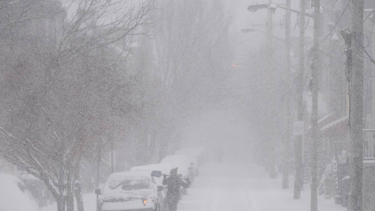
The storm arrives Wednesday evening as the closed low approaches from Baja, with snowfall ramping up across the southern Colorado mountains overnight. Heaviest accumulation across the Front Range, Pikes Peak, and Sangre de Cristos is forecast Thursday afternoon through Friday morning, with significant high-elevation snow continuing into the weekend. Front Range valley cities will see their best chance of accumulation Thursday night as cold air filters in and snow levels drop toward the foothills. Conditions should improve across most of the state by Saturday afternoon, but high-country roads will remain treacherous through the weekend as overnight refreeze cycles continue. We’ll update this article as conditions evolve.