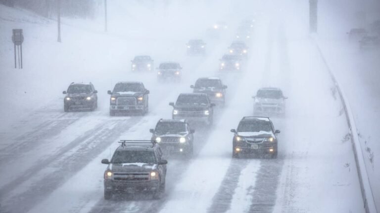
Up to 8 inches of snow could fall by Thursday morning in the National Weather Service’s high-end scenario, though its expected totals sit closer to an inch or two. One TV meteorologist puts the snow line about 2,000 feet lower than the official forecast does. For drivers, the icy stretches are likely to come overnight, when wet snow on pavement can freeze.
The Snowfall Forecast
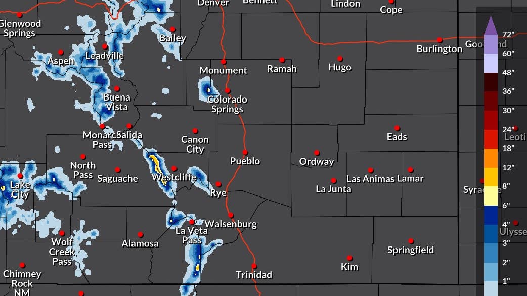
NWS Pueblo’s high-end snowfall map, issued at 12:18 p.m. ET Monday and covering the period through 8 a.m. ET Thursday, shows 6 to 8 inches in two pockets of the Sangre de Cristo Mountains, near Westcliffe and south of La Veta Pass toward Trinidad. Most of the rest of the high terrain falls in the 1- to 4-inch range, including the Sawatch Range near Leadville and Buena Vista, the San Juans around Lake City and Wolf Creek Pass, and Pikes Peak. The office’s companion map of the more likely range, issued two minutes earlier, keeps most of the same areas under 2 inches, with the heaviest totals around 3 inches in the Sangres near Westcliffe and La Veta Pass.
National Weather Service Pueblo
[MAP: NWS Pueblo “High End Amount” snowfall map, valid 6 a.m. MDT Mon Sep 28 through 6 a.m. MDT Thu Oct 1] Caption: The National Weather Service’s high-end snowfall forecast for central and southern Colorado through Thursday morning. There is a 1 in 10 chance totals end up higher than shown. (Map: National Weather Service Pueblo)
The office’s Hazardous Weather Outlook, issued earlier at 3:26 a.m. ET, framed the expected case more modestly, with snow levels staying high through Monday night and an inch or two possible above 12,000 feet. 9NEWS meteorologist Chris Bianchi said snow could reach elevations around 10,000 feet in the Colorado mountains, about 2,000 feet below that snow level. Moisture from the remnants of Hurricane Polo is feeding into the system.
Road Conditions
Monarch, Wolf Creek and La Veta passes all fall inside the shaded areas on the Pueblo map. Wet snow on those passes is most likely to turn icy overnight and early in the morning, and shaded switchbacks are the last stretches to clear once the sun comes up.
Colorado’s Passenger Vehicle Traction Law entered its seasonal window on I-70 between Dotsero and Morrison on Sept. 1, and CDOT can put its requirements into effect on any state highway during a storm, with notice posted on highway signs and COtrip.org. When it is active, tires need at least 3/16 of an inch of tread along with a mountain-snowflake, mud-and-snow or all-weather rating, unless the vehicle carries chains or an approved alternative such as an AutoSock. All-wheel and four-wheel drive vehicles are held to the same 3/16-inch tread depth. A violation carries a $100 fine plus a $33 surcharge, rising to $500 plus $157 if the vehicle ends up blocking the road and forcing a closure.
All-wheel drive helps a vehicle pull away on a slick surface but does nothing for stopping or cornering, which depend on tire tread. Colder air also reduces tire pressure by roughly 1 to 2 psi for every 10-degree drop in temperature.